My Uncle RP was so excited about going into the service as soon as he was 18 years old (1944) that He didn't wait for the draft. He contacted them. So at 18, He began his military career. He served in both the European and Pacific quadrants.
He ended up in Europe, and was in Germany after WWII to help with the recovery. These are post cards that he purchased, maybe some belonged to his wife, my Aunt Ursula, and later gave to my Grandmother.
My uncle married a lovely lady from Germany named Ursula but we call her Ulla (oo-la), and some of these post cards belonged to her family and were sent to others and are written in German. Below are the post cards with the name of the location and the Wikipedia information on each.
AUSTRIA
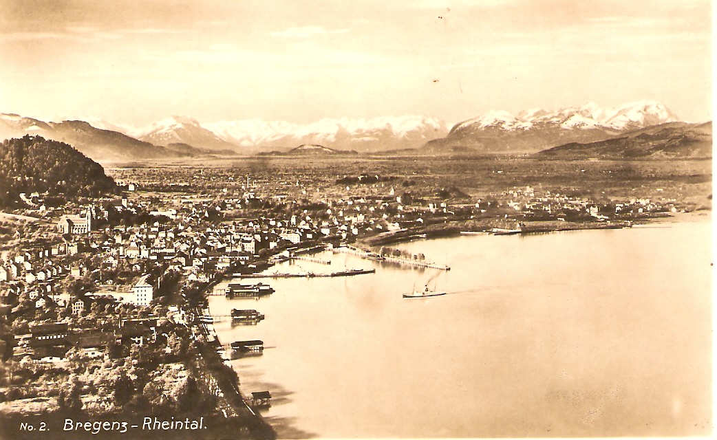
Bregenz is the capital of Vorarlberg, the westernmost federal state of Austria. The city is on the eastern shores of Lake Constance, the third-largest freshwater lake in Central Europe, between Switzerland in the west and Germany in the northwest.
The city is on a plateau falling in a series of terraces to the lake at the foot of Pfänder mountain. It is a junction of the arterial roads from the Rhine valley to the German Alpine foothills, with cruise ship services on Lake Constance.
It is famous for the annual summer music festival Bregenzer Festspiele as well as the dance festival Bregenzer Spring.
*********************

The Heiterwand is a 7.5 km long, closed rock wall in the Lechtaler Alps , Tyrol , Austria with numerous peaks.
The Heiterwand is, according to the Alpine Association, the longest closed wall of the Northern Limestone Alps , which does not fall below a minimum height of 2400 m at any point. The wall runs in a west-east direction, while the north and south show closed walls. In the west, the Steinjochl, 2198 m , with the Falschkogel, in the north of the Kromsattel, 2120 m , and the Hinterbergjoch, 2210 m , with the northern neighbor heights Tschachaun and Hinterberg ( 2303 m ). In the south, the scratching saddle separates 2130 m , from the Kienberg, 2204 m , and the Grubegg yoke, 2010 m , from the sheep's head, 2490 m . The Grubeggjoch at the southeast corner of the Heiterwand is the location of the Heiterwandhütte , in the west lies the Kromsee, north of the Steinjochl and west of the Kromsattel the Anhalter Hütte . In keeping with its structure, the Heiterwand has numerous peaks, from west to east the most important ones are:
The Heiterwand is, according to the Alpine Association, the longest closed wall of the Northern Limestone Alps , which does not fall below a minimum height of 2400 m at any point. The wall runs in a west-east direction, while the north and south show closed walls. In the west, the Steinjochl, 2198 m , with the Falschkogel, in the north of the Kromsattel, 2120 m , and the Hinterbergjoch, 2210 m , with the northern neighbor heights Tschachaun and Hinterberg ( 2303 m ). In the south, the scratching saddle separates 2130 m , from the Kienberg, 2204 m , and the Grubegg yoke, 2010 m , from the sheep's head, 2490 m . The Grubeggjoch at the southeast corner of the Heiterwand is the location of the Heiterwandhütte , in the west lies the Kromsee, north of the Steinjochl and west of the Kromsattel the Anhalter Hütte . In keeping with its structure, the Heiterwand has numerous peaks, from west to east the most important ones are:
- Maldongrat, 2544 m above sea level. A. [1]
- Fork top, 2581 m above sea level. A. [1]
- Alpeilspitzen, 2552 m above sea level. A. [1]
- Tarren Peak, 2608 m above sea level. A. [1]
- Main summit, 2639 m above sea level. A. [1]
- East Summit, 2471 m above sea level. A. [
********************

Austria, Mayrhofen in Zillertal Valley
Mayrhofen is a town in the Zillertal (Ziller river valley) in the Austrian state of Tyrol. It is located approximately an hour from the Tyrolean capital city of Innsbruck.
The town offers a variety of summer and winter sports including skiing, hiking, mountain biking and paragliding. Mayrhofen is situated near the Hintertux glacier, which, at 3,250 metres (10,660 feet) above sea level, is above the snowline. Skiing is available all year round here. Mayrhofen sits between the Penken and the Ahorn mountains which provide ski runs in the winter and mountain biking, hiking and paragliding in the summer. The Ahorn offers mainly easy and intermediate runs, but also has a long, steep black run (formerly red) which was once on the World Cup Downhill circuit but was removed as it was deemed too dangerous. The Penken mountain offers Austria's steepest piste, named Harakiri, as well as a large range of ski runs at different levels of difficulty. It is connected by lifts with the villages of Finkenberg, Lanersbach and Schwendau.
Penkenbahn and its stations
The Ahornbahn cable car has gondolas which can take up to 160 people - the biggest in Austria. The size of the gondola means that it can also be used as a "floating café" when the weather is bad.
The town also provides an excellent base for walkers - there are hundreds of clearly marked walks suitable for everyone from beginners who can walk along the Ziller valley to experienced walkers who can walk on the mountains. There are also excellent bus and rail services both along the valley and up into the mountains.
********************
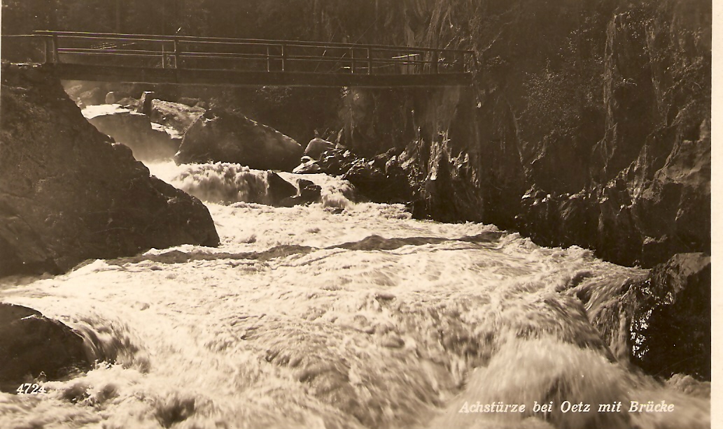
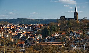
Austria, Oetz
Oetz is a municipality in the Imst district of Tyrol, Austria, located 11.7 km (7.3 mi) southeast of Imst at the lower course of the Ötztaler Ache in the outer Ötztal valley at the foot of Acherkogel mountain (3 008 m, 9,869 ft). Settlement of the area around Oetz began around two thousand years ago. The village was mentioned for the first time as Ez in 1266. The parish church was constructed in the Late Gothic style, with extensions in 1667. Baroque interior alterations were completed in 1744. The church contains a crypt, an altar with a painting of St. Michael (1683), carvings and statues.[2]
Ötz is a bi-seasonal tourist resort with approximately 350,000 overnight stays, and is a popular location for rafting and tourism. The town has a local heritage museum and art gallery called the Turmmuseum Ötz (formerly the Galerie zum alten Ötztal).[3] Nearby attractions include Lake Piburg, the Auer Klamm (gorge), the Stuibenfall (waterfall), and the waterfall on the Tumpenbach (stream).[2] The municipality has 2,265 inhabitants.
Ötz is a bi-seasonal tourist resort with approximately 350,000 overnight stays, and is a popular location for rafting and tourism. The town has a local heritage museum and art gallery called the Turmmuseum Ötz (formerly the Galerie zum alten Ötztal).[3] Nearby attractions include Lake Piburg, the Auer Klamm (gorge), the Stuibenfall (waterfall), and the waterfall on the Tumpenbach (stream).[2] The municipality has 2,265 inhabitants.
********************

Austria - Oets Archerkogel
The Acherkogel is a mountain in the Austrian Alps with a 3,008 m above sea level (AA) high summit. It is the northernmost three-thousander in the state of Tyrol. It dominates the village of Oetz in the lower valley of the River Ötz, where high rock faces rise to the northwest and southwest. To the west, a sharp ridge leads down to the Achplatte (2,423 m) and Habicher Wand (2,176 m), another ridge strikes northeast to the 2,894 m high Maningkogel. Another sharp ridge heads southeast to the 2,954 m high Wechnerkogel. In the main, the Acherkogel has the character of a rocky peak, only to the north and east are there small snowfields.It was first climbed on 24 August 1881 by Ludwig Purtscheller from the southeast and south ridge over a route that has not been used since. His climbing partner, the chamois hunter Franz Schnaiter from Kühtai, stayed behind on the south ridge when the climbing became very exposed.
- The north face (UIAA II) was first traversed by Otto Melzer in 1893 and is considered the normal route today. The Bielefelder Hütte is the usual base camp.
- The northeast ridge (UIAA III, K. Holzhammer, 1924) leads from the ridge between the Acherkogel and Maningkogel to the summit and is the most attractive climb. This route is normally tackled by crossing the Maningkogel coming from the Mittertal. The start point for this route is usually the Kühtai or Mittergrathütte.
- The southern ridge (UIAA II, F. Hörtnagl/H. Schmotzer, 1899) is usually started at the Dortmunder Hütte. The route used by the first climbers to conquer the peak runs nearby, but is no longer passable.
- The southwest face (UIAA II, F. Gstrein/F. Lantschner/M. Pfaundler 1891) used to be the normal route, but is now rarely used.
- the southeast face (UIAA V-, P. Schillfahrt/N. Raich, 1975),
- the western ridge (UIAA III, F. Lantschner, 1893) und
- the northwest face to the western ridge (F. Lantschner, 1921)
********************

Austria, Patscherkofel Mountain

Austria, Patscherkofel Mountain (back of card)
Patscherkofel is a mountain and ski area in the Alps, in Tyrol in western Austria, 7 km (4 mi.) south of Innsbruck. The peak rises to a summit elevation of 2,246 m (7,369 ft) above sea level. The town of Igls at its northwest base is at 870 m (2,854 ft), a vertical drop of 1,376 m (4,514 ft).
During both the 1964[2] and 1976 Winter Olympics,[3] the mountain was the venue for the men's downhill race, along with the bobsleigh and luge competitions in neighboring Igls. The other five alpine skiing events were held at Axamer Lizum.[4]Ski legend Franz Klammer of Austria, then age 22, won his Olympic gold medal at Patscherkofel, dramatically edging out defending Olympic champion Bernhard Russi of Switzerland by 0.33 seconds in the 1976 Downhill.[5] The 3.020 km (1.88 mi) course had a vertical drop of 870 m (2,854 ft) and started at 1,950 m (6,398 ft), well below the mountain's summit. Behind at the last timing interval, Klammer finished at 1:45.73, an average speed of 102.8 km/h (63.9 mph) and vertical descent rate of 8.2 m/s (26.9 ft/s).
Egon Zimmermann, also of Austria, took the gold medal a dozen years earlier in the 1964 Olympic downhill. His winning time was 2:18.16, more than a half minute behind Klammer's.
********************

Austria, Salzburg

Austria, Salzburg - (back of card)
Bavarian: Såizburg; literally: "Salt Fortress") is the fourth-largest city in Austria and the capital of the federal state of Salzburg.
Salzburg's "Old Town" (Altstadt) is internationally renowned for its baroque architecture and is one of the best-preserved city centers north of the Alps. It was listed as a UNESCO World Heritage Site in 1997. The city has three universities and a large population of students. Tourists also visit Salzburg to tour the historic center and the scenic Alpine surroundings.Salzburg was the birthplace of 18th-century composer Wolfgang Amadeus Mozart. In the mid‑20th century, the city was the setting for the musical play and film The Sound of Music.
********************

Austria, Satens Municipality Imst on Otztaler Ache
Sautens is a municipality in the Imst district located 9 kilometres (6 mi) southeast of Imst on the lower course of the Ötztaler Ache. The village is located to catch the sun but is protected from the wind, which makes for an especially mild climate. The main source of income is agriculture. Fruit is especially important with a good part of the harvest used to make Schnapps.
The name of the village appears to originate from Roman times. Sautens was once connected with Oetz but became its own community in 1836. Recently the village has experienced increasing tourism. The Ötztaler Ache is a right tributary of the Inn River in the Imst (district) and flows through the Ötztal valley with a length of approximately 35 kilometres (22 mi). It merges with the Inn River 8 kilometres (5.0 mi) east of Imst. The river is one of the bigger tributaries.
********************

Austria, Tirol Ramolhaus

Austria, Tirol Ramolhouse(back of card)
The Ramolhaus is an alpine club hut of the Hamburg section and the Niederelbe of the German Alpine Association . It lies on the south-east slope of the Gurgling Valley on a prominent rocky head high above the melting tongue of the Gurgler Ferner in the main ridge in the Ötztal Alps .
The Ramolhaus was built between 1881 and 1883 and extended in 1898, 1929 and 2005. Mountain climbing: The ascent takes place from Obergurgl ( 1927 m ) on the marked long distance path no. 902 in a walking time of four hours. In Obergurgl the Gurgler Ache is first crossed in a south-westerly direction. The trail leads first up the western side of the valley to two bends , then crosses a brook and continues on a moderate slope over the meadows of the Gurgler peasants. After passing the Küppele-Alm at an altitude of about 2300 m , the path initially rises steeply and crosses further streams under the rock and schrofen slopes of the Ramolkogel . Finally, we continue uphill over the Schutthänge and in a right-hand bend to the rock head on which the hut stands.
Transitions
- to the Langtalereckhütte (height 2430 m, walking time: 2 hours): The descent is first on the Hüttenweg in the direction of Obergurgl . After a short time after the first big turn, the marked but not signposted path branches off steeply on the right and meets a path, which leads from Obergurgl to Gurglerferner , at a height of approx. 2640 m. The crossing to the glacier can be critical because of a very large marginal gap (in July 2007 there was only a narrow glacier bridge). After a short glacier crossing at an altitude of almost 2600 m, marked trails are visible, which lead to the Hüttenweg to the Hochwildehaus. Follow this path to the left to Langtalereckhütte .
- to the Hochwildehaus (height 2866 m, walking time: 1.5 hours): On the way towards Langtalereckhütte until the hut climb to Hochwildehaus. There, on the right, on a good road to the hut, which is visible from afar.
- after Vent, over the Ramoljoch (altitude 3186 m, walking time: 3 1/2 hours): behind the hut, first on well-marked path over rock blocks, then a little descending on the remains of the Ramolferners . On it to the north-west, to the left a quite long ladder can be seen, over which the lowest climbing place can be easily overcome. On further safeguards follow the path in easy climbing over rocks to Ramoljoch. On the other side, you first descend on steep firns or debris on the right glacier edge and later on and on the right side of the moraine on the marked trail which descends over the slopes of the northwest crashes of the Ramolkogel to Ramolalm (altitude 2215 m) and further to Vent ,
- to the Martin-Busch-Hut (height 2501 m, walking time: 5 hours) over the Ramoljoch (altitude 3186 m): As on the way to Vent first over the Ramoljoch. At an altitude of approx. 2840 m near the Ramolbaches , turn left on a marked path and around the Vordere Spiegelkogel in a wide arc to the south in the Diembachtal . After the stream crosses westwards steeply down into the valley of the Niedertaler Ache and there over the southern bank in the valley. The stream is crossed at Schäferhütte . Across the street is a steep ascent through a moat to the broad hut trail of the Martin-Busch hut. Continue on to the hut.
Tour options
- Ramolkogel (altitude: 3550 m); Walking time: 2.5 to 3 hours
- Rear mirror cube (height 3426 m); Walking time: 2-2,5 hours
- Firmisanschide (height 3491 m); Walking time: 2-3 hours
- Schalfkogel (height 3540 m); Walking time: 3 hours
********************

Austria, Zell am see
Zell am See is the administrative capital of the Zell am See District in the Austrian state of Salzburg. The village is an important tourist destination known as Zell am See-Kaprun and is a transportation hub for the region.
The Zell Valley is a corridor in the Kitzbühel Alps, connecting the Saalfelden Basin of the Saalach River in the north and the Salzach in the south. Zell am See is located approximately 100 km (62 mi) east of Innsbruck and 30 km (19 mi) north of Mt. Grossglockner. The Old Village (Altstadt) centre of Zell am See is located on the western shore of 68-metre (223 ft) deep Lake Zell, with the villages of Thumersbach to the east, Erlberg to the southeast, and Schüttdorf directly to the south.
- Bruckberg, a residential area including the Zellermoos locality
- Erlberg on the southeastern shore of Lake Zell, including a nature reserve
- Schmitten, above Zell am See proper, location of many cableways
- Thumersbach, an affluent district and seaside resort on the eastern shore, including the summer resort of Prielau in the north
- Zell am See, with the Old Town centre and Zell am See-Süd (Schüttdorf)
The original Lake Zell reached somewhat further to the north and extended south to the Salzach river. The dimensions of the lake, however, have changed over time into marsh areas. The lake has the shape of a peanut, with an area of 4.7 square kilometres (1.8 sq mi).

Panoramic view from Lake Zell to Hoher Tenn massif (Zell am See on the right)
Zell am See provides winter skiing on the above Schmittenhöhe Mountain, the skiable area is approximately 138 km including the pistes on the Kitzsteinhorn and kaprun maiskogel. The ski pass covers the whole area including transport to and from the glacier which is open most of the year snow dependent. Zell am See is a low altitude ski area and snow cover can suffer from the temperature but the glacier has snow cover most of the year.
********************
GERMANY

Germany eburg
Germany eburg (back of card)
********************

Germany, Arenberg

Germany, Arenberg (back of card)
Arenberg, also spelled as Aremberg or Ahremberg, is a former county, principality and finally duchy that was located in what is now Germany. The Dukes of Arenberg remain a prominent Belgian noble family. First mentioned in the 12th century, it was named after the village of Aremberg in the Ahr Hills, located in today's Rhineland-Palatinate region of Germany.Aremberg was originally a county. It became a state of the Holy Roman Empire (reichsunmittelbar) in 1549, was raised to a princely county in 1576, then became a duchy in 1645.
Arenberg, also spelled as Aremberg or Ahremberg, is a former county, principality and finally duchy that was located in what is now Germany. The Dukes of Arenberg remain a prominent Belgian noble family. First mentioned in the 12th century, it was named after the village of Aremberg in the Ahr Hills, located in today's Rhineland-Palatinate region of Germany.Aremberg was originally a county. It became a state of the Holy Roman Empire (reichsunmittelbar) in 1549, was raised to a princely county in 1576, then became a duchy in 1645.
********************

Germany, Bad Ems
Bad Ems is a town in Rheinland Pfalz, Germany. It is the county seat of the Rhein-Lahn rural district and is well known as a bathing resort on the river Lahn. Bad Ems is the seat of the Verbandsgemeinde ("collective municipality") Bad Ems.
The town is built on both sides of the River Lahn, the natural border between the Taunus and the Westerwald, two parts of the Rhenish Slate Mountains. The town and its outer districts are also within the Nassau Nature Reserve.
The town is linked to a view point at the Bismarckturm (Bismarck Tower) by the Kurwaldbahn funicular railway. Bad Ems station lies on the Lahn Valley Railway.
The town was first mentioned in official documents in 880 and received its town charter in 1324. The Counts of Nassau and Katzenelnbogen rebuilt the bath. The high noble Counts loved to use it inviting friends. Days in the bath were often days with musicians and all kinds of food even swimming in the pool.[2] In the 17th and 18th centuries it was considered one of Germany's most famous bathing resorts. It reached its heyday in the 19th century when it welcomed visitors from all over the world and became the summer residence of various European monarchs and artists, including Kaiser Wilhelm I of Germany, Tsars Nicholas I and Alexander II of Russia, Richard Wagner, Fyodor Dostoevsky and Vasili Vasilyevich Vereshchagin, etc.
In 1870 the town, then part of Prussian Hesse-Nassau, became famous as the place where the Ems Dispatch originated, instigating the Franco-Prussian War.
In 1876, in the Haus Vier Türme (Four Tower House), the Ems Edict was signed by Alexander II of Russia, banning the use of the Ukrainian language. Today, a monument at the spot commemorates this historical event.
********************

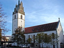
Germany, Blaubeuren
As of December, 2007 it had 11,963 inhabitants.
The core city Blaubeuren lies at the foot of the Swabian Jura, 16 km west of Ulm.
The city is borders to the north to Suppingen and Berghülen, on the east to Blaustein, in the south to Ulm and Erbach and in the west to Schelklingen and Heroldstatt.
The city Blaubeuren consists of the districts Blaubeuren, Gerhausen, Altental, Asch, Beiningen, Pappelau, Beimerstetten, Sotzenhausen, Seißen, Wennenden, Sonderbuch and Weiler with the core city Blaubeuren and 18 other villages, hamlets, farms and (individual) houses. [2]
Within the town borough are the ruins of a number of castles: Ruck Castle and Blauenstein Castle, Hohengerhausen Castle (in Gerhausen), Günzelburg Castle and Burkartsweiler (both in Seißen), Sirgenstein Castle (in Weiler), and Gleißenburg Castle (in Beiningen).[3]

Germany, Blaubeuren Abbey, Wuttemberg
The monastery was founded in 1085 by the Counts of Rück and Tübingen, against the background of the Investiture Controversy and the Hirsau Reforms. The first abbot, Adzelinus, and monks were from Hirsau Abbey.
Abbot Fabri was closely involved with the foundation of the University of Tübingen in 1477. In 1493 the high altar was created. The choir stalls by Jörg Syrlin the younger are of a similar date.
The Reformation saw the end of the Roman Catholic monastery, from which the monks were expelled in 1535, returning for a short time between 1549 and 1562.

Reredos of the high altar (central detail), by Michael Erhart
In 1563 the first Protestant abbot was appointed, and in 1565 a choir school was opened in the premises.
During the Thirty Years' War the monks returned again in 1630 and yet again in 1648, but were expelled; the choir school closed in 1630 and reopened in 1650. It was finally shut down in 1807.
A few years later in 1817 Blaubeuren became a Protestant seminary with an attached boarding school, which has remained to the present, except for a closure during World War II.
The school now operates in co-operation with the similar establishment at Maulbronn Abbey: see Evangelical Seminaries of Maulbronn and Blaubeuren.

Germany, Blaubeuren Gastholf and pension zum Oschsen

Germany, Blaubeuren Gastholf and pension zum Oschsen (interior)
********************

Germany, Bodensee River Hotel Lindauer Hof

Germany, Bodensee River, Hotel Lindauer Hof (back of card)
Lake Constance (German: Bodensee) is a lake on the Rhine at the northern foot of the Alps, and consists of three bodies of water: the Obersee or Upper Lake Constance,[1] the Untersee or Lower Lake Constance,[1] and a connecting stretch of the Rhine, called the Seerhein. These waterbodies lie within the Lake Constance Basin (Bodenseebecken), which is part of the Alpine Foreland and through which the Rhine flows.
The lake is situated in Germany, Switzerland, and Austria near the Alps. Its shorelines lie in the German states of Bavaria and Baden-Württemberg, the Austrian state of Vorarlberg, and the Swiss cantons of Thurgau, St Gallen, and Schaffhausen. The Rhine flows into the lake from the south, with its original course forming the Austro-Swiss border, and has its outflow on the "Lower Lake" where — except for Schaffhausen — it forms the German-Swiss border until the city of Basel.
Car ferries link Romanshorn to Friedrichshafen, and Konstanz to Meersburg.
The Rhine, the Bregenzer Ache, and the Dornbirner Ache carry sediments from the Alps to the lake, thus gradually decreasing the depth and coastline extension of the lake in the southeast. In antiquity the two lakes still had different names; later, for reasons which are unknown, they came to have the same name.
The lake is situated in Germany, Switzerland, and Austria near the Alps. Its shorelines lie in the German states of Bavaria and Baden-Württemberg, the Austrian state of Vorarlberg, and the Swiss cantons of Thurgau, St Gallen, and Schaffhausen. The Rhine flows into the lake from the south, with its original course forming the Austro-Swiss border, and has its outflow on the "Lower Lake" where — except for Schaffhausen — it forms the German-Swiss border until the city of Basel.
Freshwater Lake Constance is central Europe's third largest, after Lake Balaton and Lake Geneva. It is 63 km (39 mi) long, and at its widest point, nearly 14 km (8.7 mi). It covers approximately 571 km2 (220 sq mi),[2] and is 395 m (1,296 ft) above sea level. The greatest depth is 252 metres (827 ft) in the middle of the eastern part (Obersee). Its volume is approximately 10×109 m3 (13×109 cu yd). The lake has four parts: the main section, called Obersee, 476 km2 (184 sq mi); the north section, Überlinger See, 61 km2 (24 sq mi); the west section, Untersee, 63 km2 (24 sq mi); and the northwest section, the Zeller See and Gnadensee. The regulated Rhine flows into the lake in the southeast, through the Obersee, the city of Konstanz and the Untersee, and flows out near Stein am Rhein. The lake itself is an important drinking water source for southwestern Germany, called Bodensee-Wasserversorgung ("Lake Constance Water Supply"). The culminating point of the lake's drainage basin is the Tödi at 3,614 metres above sea level.[3]
Car ferries link Romanshorn to Friedrichshafen, and Konstanz to Meersburg.
Lake Constance was formed by the Rhine Glacier during the ice age and is a zungenbecken lake. After the end of the last glacial period, about 10,000 years ago, the Obersee and Untersee still formed a single lake. The downward erosion of the High Rhine caused the lake level to gradually sink and a sill, the Konstanzer Schwelle, to emerge.
The Rhine, the Bregenzer Ache, and the Dornbirner Ache carry sediments from the Alps to the lake, thus gradually decreasing the depth and coastline extension of the lake in the southeast. In antiquity the two lakes still had different names; later, for reasons which are unknown, they came to have the same name.
********************

Germany, Cologne Hohenzollembrucke Bridge

Germany, Cologne Hohenzollembrucke Bridge (back of card)
The Hohenzollern Bridge (German: Hohenzollernbrücke) is a bridge crossing the river Rhine in the German city of Cologne (German: Köln). It crosses the Rhine at kilometre 688.5. Originally, the bridge was both a railway
and street bridge, however, after its destruction in 1945 and its
subsequent reconstruction, it was only accessible to rail and pedestrian
traffic.
It is the most heavily used railway bridge in Germany with more than 1,200 trains daily,[3] connecting the Köln Hauptbahnhof and Köln Messe/Deutz stations.
The President of the Railway Directorate Cologne, Paul von Breitenbach started planning the construction and handed over this work to his successor Rudolf Schmidt in 1906. The project was headed by the railway engineer Fritz Beermann and under his direction the designs were worked out by Friedrich Dirksen. The construction of the Hohenzollern Bridge took place from 1907 to 1911. The bridge was inaugurated on 22 May 1911 by Kaiser Wilhelm II.[4]
The bridge consisted of three adjacent bridge parts, each with three iron truss arches (passage openings) in the longitudinal direction to accommodate four railroad tracks and a road. Although the location of the bridge and the railway station were already controversial in previous structures, the Hohenzollern Bridge took over the orientation of the previous bridge on the central axis of the cathedral.
After the war's end, the bridge was initially made usable on a makeshift basis but soon reconstruction began in earnest. By 8 May 1948, the Hohenzollern Bridge was accessible by pedestrians again.
The (southern) road traffic decks were removed so that the bridge now only consisted of six individual bridge decks, built partly in their old form. The surviving portals and bridge towers were not repaired and were demolished in 1958. In 1959, reconstruction of the bridge was completed.
During the 1980s, the bridge was renovated with two new tracks. A very small portion of the old road ramp on the Deutz side was preserved, together with cobblestones and tram tracks. The rest was removed in connection with the construction of the Kölntriangle development and converted into a pedestrian and bike path.
The Hohenzollern Bridge now regularly has over 1,200 trains pass through daily. The total length of the Hohenzollern Bridge is 409.19 meters (1,342.5 ft).
Since 2008 people have placed love padlocks on the fence between the footpath and the railway lines.

Hohenzollern Bridge (right) seen at night from the other side of the Rhine at Deutz.
It is the most heavily used railway bridge in Germany with more than 1,200 trains daily,[3] connecting the Köln Hauptbahnhof and Köln Messe/Deutz stations.
The bridge was constructed between 1907 and 1911 after the old bridge, the Cathedral Bridge (Dombrücke), was demolished. The Cathedral Bridge was unable to handle the increasing traffic in Cologne.[citation needed] The new bridge was named after the House of Hohenzollern, the rulers of Prussia and German Emperors. At the time, Cologne was part of the Prussian Rhine Province.
The President of the Railway Directorate Cologne, Paul von Breitenbach started planning the construction and handed over this work to his successor Rudolf Schmidt in 1906. The project was headed by the railway engineer Fritz Beermann and under his direction the designs were worked out by Friedrich Dirksen. The construction of the Hohenzollern Bridge took place from 1907 to 1911. The bridge was inaugurated on 22 May 1911 by Kaiser Wilhelm II.[4]
The bridge consisted of three adjacent bridge parts, each with three iron truss arches (passage openings) in the longitudinal direction to accommodate four railroad tracks and a road. Although the location of the bridge and the railway station were already controversial in previous structures, the Hohenzollern Bridge took over the orientation of the previous bridge on the central axis of the cathedral.
-
 Friedrich Wilhelm IV.
(north of the ramp on the right bank of the Rhine) -
 Wilhelm I.
(south of the ramp on the right bank of the Rhine)


-
 Friedrich III.
(north of the ramp on the left bank of the Rhine) -
 Wilhelm II.
(south of the ramp on the left bank of the Rhine)

.jpg)
After the war's end, the bridge was initially made usable on a makeshift basis but soon reconstruction began in earnest. By 8 May 1948, the Hohenzollern Bridge was accessible by pedestrians again.
The (southern) road traffic decks were removed so that the bridge now only consisted of six individual bridge decks, built partly in their old form. The surviving portals and bridge towers were not repaired and were demolished in 1958. In 1959, reconstruction of the bridge was completed.
During the 1980s, the bridge was renovated with two new tracks. A very small portion of the old road ramp on the Deutz side was preserved, together with cobblestones and tram tracks. The rest was removed in connection with the construction of the Kölntriangle development and converted into a pedestrian and bike path.
The Hohenzollern Bridge now regularly has over 1,200 trains pass through daily. The total length of the Hohenzollern Bridge is 409.19 meters (1,342.5 ft).
Since 2008 people have placed love padlocks on the fence between the footpath and the railway lines.

The Hohenzollern Bridge (center) about six weeks after its destruction

********************

Germany, Frankfort Bofftarte
********************

Germany, Friedichshafen
Friedrichshafen (German pronunciation: [fʁiːdʁiksˈhafn̩]) is an industrial city on the northern shoreline of Lake Constance (the Bodensee) in Southern Germany, near both the borders of Switzerland and Austria. It is the district capital (Kreisstadt) of the Bodensee district in the federal state of Baden-Württemberg. Friedrichshafen has a population of c. 58,000.
Friedrichshafen was established in 1811 as part of the new Kingdom of Württemberg, an ally of France during the Napoleonic Wars. It was named for King Frederick I of Württemberg, who privileged it as a free port and transshipment point for the kingdom's Swiss trade. Friedrichshafen was created from the former city of Buchhorn, whose coat of arms it adopted. The new city also incorporated the former village of Hofen, whose monastery was refurbished to serve as the summer residence of the Württemberger kings.
King William I continued improving the city, including the purchase of the steamship Wilhelm. Ministers and senior officials built villas around the royal castle, and many foreign tourists visited the city as well, including Tsar Alexander II of Russia. The first track laid by the Royal Württemberg State Railways connected the port to Ravensburg in 1847. Heilbronn was connected in 1850, and a ferry to Romanshorn, Switzerland, began operating in 1869. Despite their previous opposition to Prussia, under the federal structure of the German Empire, Württemberg and Friedrichshafen continued to enjoy some special privileges following their incorporation into Germany following the Franco-Prussian War.


In the aftermath of the war, Maybach and many other aviation companies turned to automobile construction, while Claudius Dornier purchased Theodor Kober's failed Flugzeugbau Friedrichshafen and established Dornier Flugzeugwerke. Because of the provisions of the Versailles treaty, many of the planes were initially produced in Italy, Spain, the Netherlands, or Japan, but resumed work at its Friedrichshafen and other German factories following the rise of the Nazi regime. The 1937 Hindenburg disaster and a subsequent embargo of American helium to Germany, however, effectively ended the production of German dirigibles. However, in 1993 the Zeppelin manufacturing company Luftschiffbau Zeppelin (LZ) was re-established and in 2001 a commercial airline Deutsche Zeppelin Reederei (DZR) began flying passenger service from Friedrichshafen Airport. As of 2012, 12 scheduled routes were offered with additional flights to selected cities.
Presently, a yearly aviation conference hosts the latest in European aircraft designs. AERO Friedrichshafen hosted an attendance of 33,400 in 2011, and 30,800 in 2012. Aero 2013 took place on 24–27 April 2013 at Friedrichshafen Airport.[2]
Friedrichshafen served the Nazis as a resort for workers. The presence of Zeppelin, Maybach, Dornier, and Zahnradfabrik made it an important industrial center for Germany during World War II. Between 1942 and 1945, the factories used Slave Labour of hundreds of concentration camp prisoners from Dachau and Dora-Mittelbau. They were housed first at Zeppelin's hangar and then, following its destruction during a raid, the V-2 factory Raderach.
The prisoners were also used to dig underground tunnels near
Friedrichshafen to protect production sites from the repeated bombing.
Between June 1943 and February 1945, the city was targeted for Allied bombing attacks. The most accurate took place on April 28, 1944, and destroyed most of the old town center. Approximately two-thirds of the city was destroyed over the course of the war.
Friedrichshafen was established in 1811 as part of the new Kingdom of Württemberg, an ally of France during the Napoleonic Wars. It was named for King Frederick I of Württemberg, who privileged it as a free port and transshipment point for the kingdom's Swiss trade. Friedrichshafen was created from the former city of Buchhorn, whose coat of arms it adopted. The new city also incorporated the former village of Hofen, whose monastery was refurbished to serve as the summer residence of the Württemberger kings.
King William I continued improving the city, including the purchase of the steamship Wilhelm. Ministers and senior officials built villas around the royal castle, and many foreign tourists visited the city as well, including Tsar Alexander II of Russia. The first track laid by the Royal Württemberg State Railways connected the port to Ravensburg in 1847. Heilbronn was connected in 1850, and a ferry to Romanshorn, Switzerland, began operating in 1869. Despite their previous opposition to Prussia, under the federal structure of the German Empire, Württemberg and Friedrichshafen continued to enjoy some special privileges following their incorporation into Germany following the Franco-Prussian War.

Castle

Zeppelin-Statue at Graf Zeppelin House, Säntis in the background
Ferdinand von Zeppelin established his famous dirigible factory at the end of the 19th century. The 128m-long LZ1 airship rose from its mooring on July 2, 1900. Other aviation companies, including Maybach, also arose in Friedrichshafen to help service the industry, which received a major impetus from the First World War. Following the Treaty of Versailles, the Kingdom of Württemberg was dissolved but the deposed royal family continued in their possession of their castle in Friedrichshafen, despite a workers' revolution there in November, 1918.
In the aftermath of the war, Maybach and many other aviation companies turned to automobile construction, while Claudius Dornier purchased Theodor Kober's failed Flugzeugbau Friedrichshafen and established Dornier Flugzeugwerke. Because of the provisions of the Versailles treaty, many of the planes were initially produced in Italy, Spain, the Netherlands, or Japan, but resumed work at its Friedrichshafen and other German factories following the rise of the Nazi regime. The 1937 Hindenburg disaster and a subsequent embargo of American helium to Germany, however, effectively ended the production of German dirigibles. However, in 1993 the Zeppelin manufacturing company Luftschiffbau Zeppelin (LZ) was re-established and in 2001 a commercial airline Deutsche Zeppelin Reederei (DZR) began flying passenger service from Friedrichshafen Airport. As of 2012, 12 scheduled routes were offered with additional flights to selected cities.
Presently, a yearly aviation conference hosts the latest in European aircraft designs. AERO Friedrichshafen hosted an attendance of 33,400 in 2011, and 30,800 in 2012. Aero 2013 took place on 24–27 April 2013 at Friedrichshafen Airport.[2]
World War II

Church of St. Nikolaus.
Between June 1943 and February 1945, the city was targeted for Allied bombing attacks. The most accurate took place on April 28, 1944, and destroyed most of the old town center. Approximately two-thirds of the city was destroyed over the course of the war.
********************

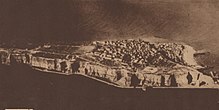
Germany, Helgoland
Heligoland (/ˈhɛlɪɡoʊlænd/; German: Helgoland [ˈhɛlɡolant]; Heligolandic Frisian: deät Lun lit. "the Land") is a small German archipelago in the North Sea.[2] The islands were at one time Danish and later British possessions.
The islands (population 1,127) are located in the Heligoland Bight (part of the German Bight) in the southeastern corner of the North Sea. They are the only German islands not in the immediate vicinity of the mainland. They lie approximately 69 kilometres (43 miles) by sea from Cuxhaven at the mouth of the River Elbe. During the period of British possession, the lyrics to "Deutschlandlied", which became the national anthem of Germany, were written on one of the islands by August Heinrich Hoffmann in 1841, while he was vacationing there.
In addition to German, the local population, who are ethnic Frisians, speak the Heligolandic dialect of the North Frisian language called Halunder. Heligoland used to be called Heyligeland, or "holy land", possibly due to the island's long association with the god Forseti.

Heligoland is located 46 kilometres (29 mi) off the German coastline and consists of two islands: the populated triangular 1 km2 (0.4 sq mi) main island (Hauptinsel) to the west, and the Düne ("dune", Heligolandic: de Halem) to the east. "Heligoland" generally refers to the former island. Düne is somewhat smaller at 0.7 km2
(0.27 sq mi), lower, and surrounded by sand beaches. It is not
permanently inhabited, but is today the location of Heligoland's airport.
The main island is commonly divided into the Unterland ("Lower Land", Heligolandic: deät Deelerlun) at sea level (to the right on the photograph, where the harbour is located), the Oberland ("Upper Land", Heligolandic: deät Boperlun) consisting of the plateau visible in the photographs and the Mittelland ("Middle Land") between them on one side of the island. The Mittelland came into being in 1947 as a result of explosions detonated by the British Royal Navy (the so-called "Big Bang"; see below).
The main island also features small beaches in the north and the south and drops to the sea 50 metres (160 ft) high in the north, west and southwest. In the latter, the ground continues to drop underwater to a depth of 56 metres (184 ft) below sea level. Heligoland's most famous landmark is the Lange Anna ("Long Anna" or "Tall Anna"), a free standing rock column (or stack), 47 metres (154 ft) high, found northwest of the island proper.
The two islands were connected until 1720, when the natural connection was destroyed by a storm flood. The highest point is on the main island, reaching 61 metres (200 ft) above sea level.
Although culturally closer to North Frisia in the German district of Nordfriesland, the two islands are part of the district of Pinneberg in the state of Schleswig-Holstein. The main island has a good harbour and is frequented mostly by sailing yachts.


The German Bight and the area around the island is known to have been inhabited since prehistoric times. Flint tools have been recovered from the bottom of the sea surrounding Heligoland. On the Oberland, prehistoric burial mounds
were visible until the late 19th century and excavations showed
skeletons and artefacts. Moreover, prehistoric copper plates have been
found under water near the island; those plates were almost certainly
made on the Oberland.[3]
In 697, Radbod, the last Frisian king, retreated to the then-single island after his defeat by the Franks—so it is written in the Life of Willebrord by Alcuin. By 1231, the island was listed as the property of the Danish king Valdemar II. Archaeological findings from the 12th to 14th century suggest the processing of copper ore on the island.[4]
There is a general understanding that the name Heligoland in origin means "Holy Land" (cf. modern Dutch and German heilig, "holy").[5] In the course of the centuries several alternative theories have been proposed, explaining the name from a Danish king Heligo or from the Frisian word hallig, meaning "salt marsh island". In this sense, the 1911 Encyclopædia Britannica suggests an etymology of "Hallaglun, or Halligland, i.e. 'land of banks, which cover and uncover'".[6]
Traditional economic activities included fishing, hunting birds and seals, wrecking and—very important for many overseas powers—piloting overseas ships into the harbours of Hanseatic League cities such as Bremen and Hamburg. Moreover, in some periods Heligoland was an excellent base point for huge herring catches. As a result, until 1714 ownership switched several times between Denmark and the Duchy of Schleswig, with one period of control by Hamburg. In August 1714, it was captured by Denmark, and it remained Danish until 1807.

On 11 September 1807, during the Napoleonic Wars, HMS Carrier brought to the Admiralty the despatches from Admiral Thomas Macnamara Russell announcing Heligoland's capitulation to the British.[8] Heligoland became a centre of smuggling and espionage against Napoleon. Denmark then ceded Heligoland to George III of the United Kingdom by the Treaty of Kiel (14 January 1814). Thousands of Germans came to Britain and joined the King's German Legion via Heligoland.
The British annexation of Heligoland was ratified by the Treaty of Paris signed on 30 May 1814, as part of a number of territorial reallocations following on the abdication of Napoleon as Emperor of the French.
The prime reason at the time for Britain's retention of a small and seemingly worthless acquisition was to restrict any future French naval aggression against the Scandinavian or German states.[9] In the event no effort was made during the period of British administration to make use of the islands for naval purposes, partly for financial reasons but principally because the Royal Navy considered Heligoland to be too exposed as a forward base.[10]
In 1826, Heligoland became a seaside spa and soon it turned into a popular tourist resort for the European upper-class. The island attracted artists and writers, especially from Germany and Austria who apparently enjoyed the comparatively liberal atmosphere, including Heinrich Heine and August Heinrich Hoffmann von Fallersleben. More vitally it was a refuge for revolutionaries of the 1830s and the 1848 German revolution.
As related in the Leisure Hour, it was "a land where there are no bankers, no lawyers, and no crime; where all gratuities are strictly forbidden, the landladies are all honest and the boatmen take no tips", while the English Illustrated Magazine provided a description the most glowing terms: "No one should go there who cannot be content with the charms of brilliant light, of ever-changing atmospheric effects, of a land free from the countless discomforts of a large and busy population, and of an air that tastes like draughts of life itself."
Britain gave up the islands to Germany in 1890 in the Heligoland–Zanzibar Treaty. The newly unified Germany was concerned about a foreign power controlling land from which it could command the western entrance to the militarily-important Kiel Canal, then under construction, and other naval installations in the area, and traded for it. A "grandfathering"/optant approach prevented the Heligolanders (as they were named in the British measures) from forfeiting advantages because of this imposed change of status.
Heligoland has an important place in the history of the study of ornithology, and especially the understanding of migration. The book Heligoland, an Ornithological Observatory by Heinrich Gätke, published in German in 1890 and in English in 1895, described an astonishing array of migrant birds on the island and was a major influence on the future studies of bird migration, in Britain in particular.

Under the German Empire, the islands became a major naval base, and during the First World War the civilian population was evacuated to the mainland. The first naval engagement of the war, the Battle of Heligoland Bight, was fought nearby in the first month of the war. The islanders returned in 1918, but during the Nazi era the naval base was reactivated. Lager Helgoland, the Nazi labour camp on Alderney, was named after the island.
Werner Heisenberg (1901–1975) first formulated the equation underlying his picture of quantum mechanics while on Heligoland in the 1920s. While a student of Arnold Sommerfeld at Munich in the early 1920s, Heisenberg first met the Danish physicist Niels Bohr. He and Bohr went for long hikes in the mountains and discussed the failure of existing theories to account for the new experimental results on the quantum structure of matter. Following these discussions, Heisenberg plunged into several months of intensive theoretical research, but met with continual frustration. Finally, suffering from a severe attack of hay fever, he retreated to the treeless (and pollenless) island of Heligoland in the summer of 1925. There he conceived the basis of the quantum theory.
In 1937, construction began on a major reclamation project (Project Hummerschere) intended to expand existing naval facilities and restore the island to its pre-1629 dimensions. The project was largely abandoned after the start of World War II and was never completed.
Heligoland also had military function as a sea fortress in Second World War. Completed and ready for use were the submarine bunker North sea III, the coastal artillery, an air-raid shelter system with extensive bunker tunnels and the airfield with the air force – Jagdstaffel Helgoland (April to October 1943).[11] Forced labour of, among others, citizens of the Soviet Union was used during the construction of military installations during World War II.[12]
On 3 December 1939, Heligoland was bombed by the Allies for the first time. The attack, by twenty four Wellington bombers of RAF Squadrons 38, 115 and 149, failed to destroy its target of German warships at anchor.[13]
Within three days in early 1940, the Royal Navy lost three submarines in Heligoland: HMS Undine (N48) on 6 January, HMS Seahorse (98S) on 7 January and HMS Starfish on 9 January.[14]
Early in the war, the island was little affected by bombing. This shows the minor military significance of the island for British forces. Through the development of the Luftwaffe, the island had largely lost its strategic importance. The Jagdstaffel Helgoland, temporarily used for defense against Allied bombing, was equipped with a rare version of the Messerschmitt Bf 109 fighter originally designed for use on aircraft carriers.
Shortly before the war ended in 1945, Georg Braun and Erich Friedrichs succeeded in forming a resistance group. However, shortly before they were to execute the plans, they were betrayed by two members of the group. About twenty men were arrested on 18 April 1945; fourteen of them were transported to Cuxhaven. After a short trial, five resisters were executed by firing squad at Cuxhaven-Sahlenburg on 21 April 1945.[15]
To honour them, in April 2010 the Helgoland Museum installed six stumbling blocks on the roads of Heligoland. Their names are Erich P. J. Friedrichs, Georg E. Braun, Karl Fnouka, Kurt A. Pester, Martin O. Wachtel, and Heinrich Prüß.
With two waves of attacks on 18 and 19 April 1945, 1,000 aircraft of the British Royal Air Force dropped about 7,000 bombs. The majority of the population survived in the bomb shelters. 285 people were killed, including many Luftwaffenhelfer and naval auxiliaries.[16] 128 of the casualties were anti-aircraft crew. The bomb attacks rendered the island uninhabitable, and it was evacuated.
The islands (population 1,127) are located in the Heligoland Bight (part of the German Bight) in the southeastern corner of the North Sea. They are the only German islands not in the immediate vicinity of the mainland. They lie approximately 69 kilometres (43 miles) by sea from Cuxhaven at the mouth of the River Elbe. During the period of British possession, the lyrics to "Deutschlandlied", which became the national anthem of Germany, were written on one of the islands by August Heinrich Hoffmann in 1841, while he was vacationing there.
In addition to German, the local population, who are ethnic Frisians, speak the Heligolandic dialect of the North Frisian language called Halunder. Heligoland used to be called Heyligeland, or "holy land", possibly due to the island's long association with the god Forseti.

1910 map of Heligoland. The islands' coastlines have changed somewhat since this map was created.
The main island is commonly divided into the Unterland ("Lower Land", Heligolandic: deät Deelerlun) at sea level (to the right on the photograph, where the harbour is located), the Oberland ("Upper Land", Heligolandic: deät Boperlun) consisting of the plateau visible in the photographs and the Mittelland ("Middle Land") between them on one side of the island. The Mittelland came into being in 1947 as a result of explosions detonated by the British Royal Navy (the so-called "Big Bang"; see below).
The main island also features small beaches in the north and the south and drops to the sea 50 metres (160 ft) high in the north, west and southwest. In the latter, the ground continues to drop underwater to a depth of 56 metres (184 ft) below sea level. Heligoland's most famous landmark is the Lange Anna ("Long Anna" or "Tall Anna"), a free standing rock column (or stack), 47 metres (154 ft) high, found northwest of the island proper.
The two islands were connected until 1720, when the natural connection was destroyed by a storm flood. The highest point is on the main island, reaching 61 metres (200 ft) above sea level.
Although culturally closer to North Frisia in the German district of Nordfriesland, the two islands are part of the district of Pinneberg in the state of Schleswig-Holstein. The main island has a good harbour and is frequented mostly by sailing yachts.
History

Flag of the British Administration of Heligoland, 1807–1890

Bird's eye view, Heligoland, c. 1890–1900

Prehistoric cist grave from Heligoland, now in Berlin's Neues Museum
In 697, Radbod, the last Frisian king, retreated to the then-single island after his defeat by the Franks—so it is written in the Life of Willebrord by Alcuin. By 1231, the island was listed as the property of the Danish king Valdemar II. Archaeological findings from the 12th to 14th century suggest the processing of copper ore on the island.[4]
There is a general understanding that the name Heligoland in origin means "Holy Land" (cf. modern Dutch and German heilig, "holy").[5] In the course of the centuries several alternative theories have been proposed, explaining the name from a Danish king Heligo or from the Frisian word hallig, meaning "salt marsh island". In this sense, the 1911 Encyclopædia Britannica suggests an etymology of "Hallaglun, or Halligland, i.e. 'land of banks, which cover and uncover'".[6]
Traditional economic activities included fishing, hunting birds and seals, wrecking and—very important for many overseas powers—piloting overseas ships into the harbours of Hanseatic League cities such as Bremen and Hamburg. Moreover, in some periods Heligoland was an excellent base point for huge herring catches. As a result, until 1714 ownership switched several times between Denmark and the Duchy of Schleswig, with one period of control by Hamburg. In August 1714, it was captured by Denmark, and it remained Danish until 1807.
| British Administration of Heligoland Britische Verwaltung von Helgoland (German) |
|||||
| Colony of the British Empire | |||||
|
|||||
Flag |
|||||
| Government | Colony | ||||
| Monarch | |||||
| • | 1807–1820 (first) | George III | |||
| • | 1837–1890 (last) | Victoria | |||
| Lieutenant Governor/Governor[7] | |||||
| • | 1807–1814 (first) | Corbet James d'Auvergne | |||
| • | 1888–1890 (last) | Arthur Cecil Stuart Barkly | |||
| Historical era | |||||
| • | Treaty of Kiel | 1807 | |||
| • | Heligoland–Zanzibar Treaty | 1890 | |||
| Today part of | |||||

Postage stamp showing Queen Victoria and denominated in Hamburg schillings. From 1875 its postage stamps were denominated in both sterling and gold marks.
The British annexation of Heligoland was ratified by the Treaty of Paris signed on 30 May 1814, as part of a number of territorial reallocations following on the abdication of Napoleon as Emperor of the French.
The prime reason at the time for Britain's retention of a small and seemingly worthless acquisition was to restrict any future French naval aggression against the Scandinavian or German states.[9] In the event no effort was made during the period of British administration to make use of the islands for naval purposes, partly for financial reasons but principally because the Royal Navy considered Heligoland to be too exposed as a forward base.[10]
In 1826, Heligoland became a seaside spa and soon it turned into a popular tourist resort for the European upper-class. The island attracted artists and writers, especially from Germany and Austria who apparently enjoyed the comparatively liberal atmosphere, including Heinrich Heine and August Heinrich Hoffmann von Fallersleben. More vitally it was a refuge for revolutionaries of the 1830s and the 1848 German revolution.
As related in the Leisure Hour, it was "a land where there are no bankers, no lawyers, and no crime; where all gratuities are strictly forbidden, the landladies are all honest and the boatmen take no tips", while the English Illustrated Magazine provided a description the most glowing terms: "No one should go there who cannot be content with the charms of brilliant light, of ever-changing atmospheric effects, of a land free from the countless discomforts of a large and busy population, and of an air that tastes like draughts of life itself."
Britain gave up the islands to Germany in 1890 in the Heligoland–Zanzibar Treaty. The newly unified Germany was concerned about a foreign power controlling land from which it could command the western entrance to the militarily-important Kiel Canal, then under construction, and other naval installations in the area, and traded for it. A "grandfathering"/optant approach prevented the Heligolanders (as they were named in the British measures) from forfeiting advantages because of this imposed change of status.
Heligoland has an important place in the history of the study of ornithology, and especially the understanding of migration. The book Heligoland, an Ornithological Observatory by Heinrich Gätke, published in German in 1890 and in English in 1895, described an astonishing array of migrant birds on the island and was a major influence on the future studies of bird migration, in Britain in particular.

Aerial photograph showing new fortifications in 1919.

Heligoland about 1929–30
Werner Heisenberg (1901–1975) first formulated the equation underlying his picture of quantum mechanics while on Heligoland in the 1920s. While a student of Arnold Sommerfeld at Munich in the early 1920s, Heisenberg first met the Danish physicist Niels Bohr. He and Bohr went for long hikes in the mountains and discussed the failure of existing theories to account for the new experimental results on the quantum structure of matter. Following these discussions, Heisenberg plunged into several months of intensive theoretical research, but met with continual frustration. Finally, suffering from a severe attack of hay fever, he retreated to the treeless (and pollenless) island of Heligoland in the summer of 1925. There he conceived the basis of the quantum theory.
In 1937, construction began on a major reclamation project (Project Hummerschere) intended to expand existing naval facilities and restore the island to its pre-1629 dimensions. The project was largely abandoned after the start of World War II and was never completed.
World War II
The area was the setting of the aerial Battle of the Heligoland Bight in 1939, a result of British bombing attempts on German Navy vessels in that area. The area's waters were frequently mined by British aircraft.Heligoland also had military function as a sea fortress in Second World War. Completed and ready for use were the submarine bunker North sea III, the coastal artillery, an air-raid shelter system with extensive bunker tunnels and the airfield with the air force – Jagdstaffel Helgoland (April to October 1943).[11] Forced labour of, among others, citizens of the Soviet Union was used during the construction of military installations during World War II.[12]
On 3 December 1939, Heligoland was bombed by the Allies for the first time. The attack, by twenty four Wellington bombers of RAF Squadrons 38, 115 and 149, failed to destroy its target of German warships at anchor.[13]
Within three days in early 1940, the Royal Navy lost three submarines in Heligoland: HMS Undine (N48) on 6 January, HMS Seahorse (98S) on 7 January and HMS Starfish on 9 January.[14]
Early in the war, the island was little affected by bombing. This shows the minor military significance of the island for British forces. Through the development of the Luftwaffe, the island had largely lost its strategic importance. The Jagdstaffel Helgoland, temporarily used for defense against Allied bombing, was equipped with a rare version of the Messerschmitt Bf 109 fighter originally designed for use on aircraft carriers.
Shortly before the war ended in 1945, Georg Braun and Erich Friedrichs succeeded in forming a resistance group. However, shortly before they were to execute the plans, they were betrayed by two members of the group. About twenty men were arrested on 18 April 1945; fourteen of them were transported to Cuxhaven. After a short trial, five resisters were executed by firing squad at Cuxhaven-Sahlenburg on 21 April 1945.[15]
To honour them, in April 2010 the Helgoland Museum installed six stumbling blocks on the roads of Heligoland. Their names are Erich P. J. Friedrichs, Georg E. Braun, Karl Fnouka, Kurt A. Pester, Martin O. Wachtel, and Heinrich Prüß.
With two waves of attacks on 18 and 19 April 1945, 1,000 aircraft of the British Royal Air Force dropped about 7,000 bombs. The majority of the population survived in the bomb shelters. 285 people were killed, including many Luftwaffenhelfer and naval auxiliaries.[16] 128 of the casualties were anti-aircraft crew. The bomb attacks rendered the island uninhabitable, and it was evacuated.
********************

Germany, Hesse Waldeck Frankenberg District
Frankenberg an der Eder is a town in Waldeck-Frankenberg district and regional center in Hesse, Germany.
The mountain at a ford over the Eder north of the Burgwald range was for a long time a fortified place, playing an especially important rôle under the Franks in the Saxon Wars. The current town was built in 1233-1234 by the Thuringian Landgrave and quickly earned economic importance for its location at the junction of two trade routes. The downtown core consists of the renovated Old Town and the likewise renovated New Town with many half-timbered houses.
Geography

Frankenberg lies between the Burgwald range in the south and the
Breite Struth (hills) in the northwest, where the river Nemphe empties
into the Eder. North of the town, the Nuhne empties into the same river
at the constituent community of Schreufa. It is 27 kilometres (17 miles)
north of Marburg.

16 former living places around town
were forsaken, but many of their names live on in names given fields and
meadows. Frankenberg was soon girt by a mighty town wall. Of the 25
towers and gates, only the Hexenturm ("Witches Tower") still stands today; all five town gates have vanished.

The new community grew quickly, underpinned by a healthy merchant and
craftsman class. It was a sign of the growing prosperity that already
in 1286, after the church dependence of Geismar had been broken,
building work began on the great Marienkirche (Church of Mary) – now known as the Liebfrauenkirche – which was built using the Elisabethkirche in Marburg
as a model. Frankenberg buyers and sellers broadly fostered trade
links, as witnessed not only by the weekly markets, but also by the four
yearly fairs. The economic upswing also afforded a quick upward
cultural development. Already in the 13th century, Frankenberg had a
town school (Lateinschule), which reached its greatest heights about 1500. Onto the church, which had been completed in 1353, the Marienkapelle (Mary's Chapel) was built between 1370 and 1380, one of Thyle von Frankenberg's masterworks.


In the 16th century, the town was built anew. Only the Steinhaus
("Stone House") had withstood the fire right up to the roof. Building
work on the stately new town hall, which is still the town's landmark
today, was begun in 1509. After 1526, as was true throughout Hesse, the Reformation
was introduced into Frankenberg by the preachers Ludwig Stippius and
Caspar Tholde. The church reform forced by Landgrave Moritz in 1606 is
responsible for destroying the apostle and saint statues in the church
and the Marienkapelle. In Plague years between 1529 and 1611, the University of Marburg five times sought refuge within Frankenberg's walls. The Thirty Years' War
(1618 to 1648) struck the town a heavy blow. Frankenberg's advantageous
location at an important crossroads became the town's scourge, as it
also did in later wars. Troops from both sides on their way through, and
a long occupation by Imperial troops, brought immeasurable harm down on
the town. Nearby, on the Totenhöhe ("Dead Man's Heights"), a battle was fought in 1646 between troops from Hesse-Darmstadt and troops from Hesse-Kassel (or Hesse-Cassel), with the latter reinforced by Swedish troops and winning the encounter.
The town's water supply originally came through public and private wells. After the Great Fire of 1476, this was supplemented in 1502 by building the waterworks in Niedermühle whereby Eder water, driven by a waterwheel in the Eder, was fed into the Old Town and distributed to various cisterns. In 1899, a public waterworks was built. Instead of using the Eder's water, however, the new waterworks used springwater from the pond lands in Teichmühle driven by water power from the Nemphe, and also by motor power, into a tank high up the Burgberg, whence it was piped to individual houses. In 1913, the Gernshäuser Springs came along whose water still runs down the slopes even today into the lower town. In 1903, in the municipal building "Niedermühle", a turbine was built that was driven by Eder water. With this turbine and a naturally aspirated gas engine (60 horsepower), direct current was generated for Frankenberg's first electric light. As part of the electrification of North Hesse, alternating current power supplies were ensured with PreussenElektra's overland cables in 1921. In 1871, a land survey of the Frankenberg municipal area was done. Land acquisitions were undertaken in the 1890s and were completed by 1904. The economic upswing before the First World War was expressed in population figures that were rising again. In 1908, 3,314 people lived in Frankenberg. The town now began to expand beyond its limits, which had been in place since its founding, marked by the town wall. In 1890, the railway station, the Thonet chair factory and soon afterwards the new post office were built behind the provincial council office. In 1900, the savings bank building went up before the Geismarer Tor ("Geismar Gate"). Following this were the Amt court in 1903 and the teachers' college with a drill school in 1905. The building nowadays houses the Gymnasium (Edertalschule). In 1913, the town school (Ortenberg-Schule) came into being. In 1905, before the Linnertor (gate), the Jewish school was built. An economic and cultural stagnation was brought upon Frankenberg by the First World War. During the Second World War, too, there were very few meaningful changes in town, other than a few new houses in Ederdorf and a few building renovations and expansions in the main town. Even a town expansion of 144 ha east of the cemetery, as recommended in 1914 in a report about the Gau of Frankenberg by the Research Body for German Housing Business (Forschungsstätte für die Deutsche Siedlungsgesellschaft) at the Reichsherrnstättenamt, was never undertaken.
On the floodplain in the 1960s an industrial park opened up – and has been expanded – in which a few sizeable new businesses have been able to establish themselves, strengthening Frankenberg's economic power and improving its economic structure. Also built on the floodplain was a new emergency management centre that houses all institutions involved in protection against catastrophes, such as the fire brigade – local and from farther afield – emergency management, Technisches Hilfswerk and the German Red Cross. In 1967 a new indoor swimming pool was built right near the parklands on Teichweg and in 1972, an outdoor swimming pool with a miniature golf course was built onto it. As part of municipal reforms in 1970 and 1971, 12 villages voluntarily joined the town of Frankenberg, thereby enlarging the town's municipal area from 2 736 ha to 12 518 ha and increasing the population from 9,397 to 15,263. In 1974, owing to the realignment of municipalities in Hesse, Frankenberg, which had been a district seat, had to give this status up to Korbach; on 1 January 1974, Korbach became the district seat of the new district of Waldeck-Frankenberg, created through a merger of the former districts of Frankenberg and Waldeck. The postal service built a new post office in the 1970s on Sudetenstraße and a telecommunications office on Marburger Straße with a transmission tower, whose height rivalled the Liebfrauenkirche tower's. The Ederberglandhalle, finished in time for the Hessentag (yearly state fair and festival in Hesse, held in a different town every year) in 1989, is today the hub of the town's cultural life. The greatest influence on Frankenberg's development came from the town renovation plans, initiated by town council's decision on 10 August 1967, for the Old Town and New Town centres (16 ha and 8 ha respectively). Remodelling the Old Town and New Town by building parking garages and pedestrian precincts changed the shape of the town core, but not always to its advantage. One hundred half-timbered buildings were torn down as part of this renovation and were replaced by new buildings that were not always agreeable. The remodelling did, however, contribute to improving the town's economic situation considerably. Frankenberg has become a shopping town, inviting people to take a walk and visit the Old Town and New Town.
The mountain at a ford over the Eder north of the Burgwald range was for a long time a fortified place, playing an especially important rôle under the Franks in the Saxon Wars. The current town was built in 1233-1234 by the Thuringian Landgrave and quickly earned economic importance for its location at the junction of two trade routes. The downtown core consists of the renovated Old Town and the likewise renovated New Town with many half-timbered houses.
Geography
_Altstadt.jpg)
Frankenberg

Aerial view
Frankenberg borders in the north on the community of Vöhl, in the east on the town of Frankenau, in the southeast on the community of Haina, in the southwest on the community of Burgwald, in the west on the community of Allendorf, and in the northwest on the town of Lichtenfels (all in Waldeck-Frankenberg).
At the foot of the mountain on which the town of Frankenberg was built crossed two old military and commercial roads. From the area of the lower Main, from the Burgwald range, came the Weinstraße ("Wine Road"), crossing the Eder through a ford and then going on through the heights on the river's left bank to Westphalia. From the west came the Siegener Straße ("Siegen Road") over the Lahn-Eder watershed, leading round the mountain to the north and further on into Lower Hesse.

Castle hill with remains of an open-air theater

Liebfrauenkirche with park
The steady population growth brought the need for a bigger town, and so, on the Landgrave's initiative, the New Town was established at the foot of the mountain towards the Eder. It rose along the Siegener Straße (a commercial road), even having its own administration, although it was still under the Old Town's church and court, and had no marketplace of its own. Only in 1556 was it united with the Old Town into one municipality.
On 9 May 1476, a fire broke out that burnt the whole New Town and Old Town down. Even the Liebfrauenkirche was burnt right out. Although the townsfolk promptly tackled the job of building their town over again, Frankenberg, which had hitherto been among Hesse's most important towns, never fully recovered from this catastrophic fire. In 1507, half the New Town burnt down again. The seat of the Amt of Frankenberg, which had existed since the 14th century and which included the town areas of Frankenberg and Frankenau as well as half the court region of Geismar, was relocated to the Wolkersdorf Hunting Lodge, itself built on the site of an old moat-ringed castle. Thus was born the Amt of Wolkersdorf, to which belonged the Röddenau lower courts (with the amalgamated courts of Rengershausen and Bromskirchen) and the Geismar court (the "Ämmetche"). Only in the 16th century was there once again an Amt of Frankenberg under which were united not only the town but also Rodenbach farm and the Wiesenfeld wine cellars. The Amt was united with the Amt of Wolkersdorf in 1604.
.jpg)
Frankenberg 1655 (Topographia Germaniae)

The town hall, from the Upper Market
Frankenberg up until the First World War
Under Napoleonic rule (1806 to 1813), Frankenberg was home to the seat of a canton in the department of Werra in the Kingdom of Westphalia. In 1821, Frankenberg became district seat (Kreisstadt) of the newly formed district of Frankenberg, consisting of the former Ämter of Frankenberg, Hessenstein, Rosenthal and Haina, along with the court district of Viermünden. The district council – after 1834 provincial council – had its seat in the St. Georgenberg Monastery. Frankenberg had sunk down from a key town to an unnotable, mean little town. Its economic underpinnings, as had already been so in the Middle Ages, were the clothiers and the tanners. Whereas by the late 18th century the woolmen's and clothiers' guild had 106 members and the tanners' guild 46, by the middle of the 19th century, membership in the woolmen's and clothiers' guild rose to 140, and red and white tanning blossomed once again. Alongside other guilds, there was also at that time a stocking weavers' and glovers' guild. In the second half of the century, a noticeable downswing set in, which could even be seen in population figures (2,611 in 1787, 3,163 in 1867 and 2,787 in 1894). From 1590 to 1818, copper and silver ore was mined and smelted near Frankenberg. During the 19th century, various attempts were undertaken to get the mining industry running again, but in 1875, it was abandoned for good. Sights between Frankenberg and Geismar still bear witness today to the mining in days of yore, as do some placenames such as "Alte Hütte" ("Old Ironworks"), "Neue Hütte" ("New Ironworks") and "Zechenhaus" ("Colliery House"). Only when the railway reached Frankenberg did a new economic upswing, albeit a modest one, come to the town. In 1890, the Marburg-Frankenberg line was opened, and the Brothers Thonet from Vienna furthermore set up a chair-making factory near the railway station making use of the wealth of wood in the area. Ten years later, the line was extended through Korbach to Warburg, making connections to Westphalia. In 1908, the stretch of line to Bestwig was completed, and in 1910, so was the one to Berleburg.The town's water supply originally came through public and private wells. After the Great Fire of 1476, this was supplemented in 1502 by building the waterworks in Niedermühle whereby Eder water, driven by a waterwheel in the Eder, was fed into the Old Town and distributed to various cisterns. In 1899, a public waterworks was built. Instead of using the Eder's water, however, the new waterworks used springwater from the pond lands in Teichmühle driven by water power from the Nemphe, and also by motor power, into a tank high up the Burgberg, whence it was piped to individual houses. In 1913, the Gernshäuser Springs came along whose water still runs down the slopes even today into the lower town. In 1903, in the municipal building "Niedermühle", a turbine was built that was driven by Eder water. With this turbine and a naturally aspirated gas engine (60 horsepower), direct current was generated for Frankenberg's first electric light. As part of the electrification of North Hesse, alternating current power supplies were ensured with PreussenElektra's overland cables in 1921. In 1871, a land survey of the Frankenberg municipal area was done. Land acquisitions were undertaken in the 1890s and were completed by 1904. The economic upswing before the First World War was expressed in population figures that were rising again. In 1908, 3,314 people lived in Frankenberg. The town now began to expand beyond its limits, which had been in place since its founding, marked by the town wall. In 1890, the railway station, the Thonet chair factory and soon afterwards the new post office were built behind the provincial council office. In 1900, the savings bank building went up before the Geismarer Tor ("Geismar Gate"). Following this were the Amt court in 1903 and the teachers' college with a drill school in 1905. The building nowadays houses the Gymnasium (Edertalschule). In 1913, the town school (Ortenberg-Schule) came into being. In 1905, before the Linnertor (gate), the Jewish school was built. An economic and cultural stagnation was brought upon Frankenberg by the First World War. During the Second World War, too, there were very few meaningful changes in town, other than a few new houses in Ederdorf and a few building renovations and expansions in the main town. Even a town expansion of 144 ha east of the cemetery, as recommended in 1914 in a report about the Gau of Frankenberg by the Research Body for German Housing Business (Forschungsstätte für die Deutsche Siedlungsgesellschaft) at the Reichsherrnstättenamt, was never undertaken.
Weimar Republic and Third Reich
Only slowly did Frankenberg recover from the First World War's consequences. As the money lost its worth and the attendant economic downfall set in, there came a new wave of emigration from the town, especially overseas. In 1922, the town got its own Gymnasium, as of 1925 named the Edertalschule (Eder Valley School). When the inflation ended in autumn of 1923, bringing with it an upswing in the economy, this was expressed in, among other ways, the Stoelcker chair factory setting up shop in town in 1925. The upswing, however, did not last long. The world economic crisis struck the structurally weak and highly indebted town hard. In the face of rising joblessness and social need, the NSDAP's propaganda was finding fertile ground here, as it was throughout the district, by the end of the 1920s, which was reflected in election results. After Hitler seized power in January 1933, Frankenberg town council gave several places new names: the Steingasse ("Stone Lane") became Adolf-Hitler-Straße, Röddenauer Straße became Hermann-Göring-Straße, and the Untermarkt ("Lower Market") became Hindenburg-Platz, and the people, above all the youth, were infected with the Nazi ideology. Worst affected by all this were Frankenberg's Jewish townsfolk, who, already having had to deal with discrimination and harassment for a long time, were systematically persecuted, stripped of their rights, and in the end, murdered. Luckily, most of the town's Jews had managed to get out of Germany early enough. Those who stayed behind because they either had no money or kin living abroad or trusted that nothing would happen to them, had all been deported to the death camps by 1942. At least eight Jews from Frankenberg and three from the outlying centre of Röddenau lost their lives to the Nazis' racial madness. Since 1988, a memorial plaque at the town hall has recalled Frankenberg's Jewish community and Holocaust victims. During the Second World War, Frankenberg was spared for the most part any direct exposure to military action. There were, however, two air-raids in March 1945 on the railway station in which more than 90 people lost their lives. In August 1944, a Wehrmacht field hospital was moved from Grodno to Frankenberg and housed at the town's two schools and at the Amt court. When the Americans came marching in on 29 March 1945, they met no resistance whatsoever. Two hundred and eighty-five men from Frankenberg never came home from the war.Frankenberg after the Second World War
With the stream of refugees after the Second World War, Frankenberg's population rose sharply by two thousand, requiring that the town's building area be expanded. Already before currency reform in 1948, the Frankenberg district had begun building the district hospital on the Goßberg, to which a nursing school and nurses' residence were added in the early 1970s. In 1975, the hospital was expanded and has since then become a modern Hessenklinik ("Hesse Clinic"). Since 1962, Frankenberg has been a garrison town. In 1962-1963, the problem of sewage disposal was solved by building a sewage treatment plant, which was expanded in 1978. The rising demand for water was satisfied by boring deep wells and building both elevated water tanks and pumping works. Also rising was demand for electricity and this was satisfied by building new 20 kV loop line and new transformer stations. The existing schools (Ortenbergschule, Edertalschule, Burgwaldschule) were expanded into modern schools and in Wermersdorf, the Wigand-Gerstenberg-Schule (named after the chronicler) was newly built. The district vocational school, which had been housed in the barracks at the sporting ground on the Eder since 1950, was newly built in the early 1960s on Marburger Straße and expanded into an effective vocational education centre with a vocational technical school and upper school for engineering. Near Geismarer Straße, the Friedrich-Trost-Schule (school for students with learning disabilities) was built. From it grew in the early 1980s the Kegelberg-Schule (school for educables). Late in the 1970s, there came into being on the Kegelberg a workshop for those with handicaps and an integrative kindergarten sponsored by the Lebenshilfe-Werk ("Assisted Daily Living Works")On the floodplain in the 1960s an industrial park opened up – and has been expanded – in which a few sizeable new businesses have been able to establish themselves, strengthening Frankenberg's economic power and improving its economic structure. Also built on the floodplain was a new emergency management centre that houses all institutions involved in protection against catastrophes, such as the fire brigade – local and from farther afield – emergency management, Technisches Hilfswerk and the German Red Cross. In 1967 a new indoor swimming pool was built right near the parklands on Teichweg and in 1972, an outdoor swimming pool with a miniature golf course was built onto it. As part of municipal reforms in 1970 and 1971, 12 villages voluntarily joined the town of Frankenberg, thereby enlarging the town's municipal area from 2 736 ha to 12 518 ha and increasing the population from 9,397 to 15,263. In 1974, owing to the realignment of municipalities in Hesse, Frankenberg, which had been a district seat, had to give this status up to Korbach; on 1 January 1974, Korbach became the district seat of the new district of Waldeck-Frankenberg, created through a merger of the former districts of Frankenberg and Waldeck. The postal service built a new post office in the 1970s on Sudetenstraße and a telecommunications office on Marburger Straße with a transmission tower, whose height rivalled the Liebfrauenkirche tower's. The Ederberglandhalle, finished in time for the Hessentag (yearly state fair and festival in Hesse, held in a different town every year) in 1989, is today the hub of the town's cultural life. The greatest influence on Frankenberg's development came from the town renovation plans, initiated by town council's decision on 10 August 1967, for the Old Town and New Town centres (16 ha and 8 ha respectively). Remodelling the Old Town and New Town by building parking garages and pedestrian precincts changed the shape of the town core, but not always to its advantage. One hundred half-timbered buildings were torn down as part of this renovation and were replaced by new buildings that were not always agreeable. The remodelling did, however, contribute to improving the town's economic situation considerably. Frankenberg has become a shopping town, inviting people to take a walk and visit the Old Town and New Town.
********************

Germany, Langenselbold

Germany, Langenselbold (back of card)
Langenselbold ( German pronunciation (help·info)) is a town in the Main-Kinzig district, in Hesse, Germany. It is situated on the river Kinzig, 10 km east of Hanau. In 2009, the town hosted the 49th Hessentag state festival.
********************

Germany, Osteebad Ostsee Schleswig Holstein Dahme

Germany, Osteebad Ostsee Schleswig Holstein Dahme
Resort area in Germany

Germany, Ostssebad (Binz)
Binz is the largest seaside resort on the German island of Rügen.
It is situated between the bay of Prorer Wiek and the Schmachter See (a lake) in the southeast of the island. To the north of Binz stretches the Schmale Heide (the "narrow heath"), a tongue of land which joins the Muttland region of Rügen to the Jasmund peninsula. The land to the south and east of Binz is hilly, reaching a height of over 100 metres above sea level.
Binz is famous for its charming and well-kept historical resort architecture and the natural scenery, close to the Jasmund National Park and its chalk cliffs.
Binz lies on the eastern coast of the island of Rügen between the bay of Prorer Wiek and the lake of Schmachter See. North of Binz is the Schmale Heide, a neck of land that links the Muttland – Rügen's central region – with the peninsula of Jasmund. East and south of the municipality, the land is rolling, in the southeast, in the Granitz, the land climbs to just over 100 m above sea level (NN). The resort of Prora belongs to Binz.
********************

Germany, Saarbrucken (aerial view)


Germany, Saarbrucken
Saarbrücken (German pronunciation: [zaːɐ̯ˈbʁʏkn̩] (
Saarbrücken was created in 1909 by the merger of three towns, Saarbrücken, St. Johann, and Malstatt-Burbach. It used to be the industrial and transport centre of the Saar coal basin. Products included iron and steel, sugar, beer, pottery, optical instruments, machinery, and construction materials.
Historic landmarks in the city include the stone bridge across the Saar (1546), the Gothic church of St. Arnual, the 18th-century Saarbrücken Castle, and the old part of the town, the Sankt Johanner Markt (Market of St. Johann).
Twice in the 20th century Saarbrücken was separated from Germany: in 1920–35 as capital of the Territory of the Saar Basin and in 1947–56 as capital of the Saar Protectorate.
In modern German, Saarbrücken literally translates to Saar bridges (Brücken is the plural of Brücke), and indeed there are about a dozen bridges across the Saar river. However, the name actually predates the oldest bridge in the historic center of Saarbrücken, the Alte Brücke, by at least 500 years.[wp 1]
The name Saar stems from the Celtic word sara (streaming water), and the Roman name of the river, saravus.[3]
However, there are three theories about the origin of the second part of the name Saarbrücken.
The most popular theory states that the historical name of the town, Sarabrucca, derived from the Celtic word briga (hill, or rock, big stone[3]), which became Brocken (can mean rock or boulder) in High German. The castle of Sarabrucca was located on a large rock by the name of Saarbrocken overlooking the river Saar.[4]
A minority opinion holds that the historical name of the town, Sarabrucca, derived from the Old High German word Brucca(in German), meaning bridge, or more precisely a Corduroy road, which was also used in fords. Next to the castle, there was a ford allowing land-traffic to cross the Saar.[5]

Ruins of the Roman camp Römerkastell

The Mithras shrine at Halberg hill
World War II
Saarbrücken was heavily bombed in World War II.[15] In total 1,234 people (1.1 percent of the population) in Saarbrücken were killed in bombing raids 1942-45.[16] 11,000 homes were destroyed and 75 percent of the city left in ruins.The Royal Air Force raided Saarbrücken at least 10 times. Often employing area bombing, the Royal Air Force used total of at least 1495 planes to attack Saarbrücken, killing a minimum of 635 people and heavily damaging more than 8400 buildings, of which more than 7700 were completely destroyed, thus dehousing more than 50,000 people.[15] The first major raid on Saarbrücken was done by 291 aircraft of the Royal Air Force on July 29, 1942, targeting industrial facilities. Losing 9 aircraft, the bombers destroyed almost 400 buildings, damaging more than 300 others, and killed more than 150 people. [17] On August 28, 1942, 113 Royal Air Force planes raided Saarbrücken doing comparably little damage due to widely scattered bombing.[17] After the Royal Air Force mistakenly bombed Saarlouis instead of Saarbrücken on September 1, 1942, it raided Saarbrücken with 118 planes on September 19, 1942, causing comparably little damage as the bombing scattered to the west of Saarbrücken due to ground haze.[17] There were small raids with 28 Mosquitos[17] on April 30, 1944, with 33 Mosquitos[17] on June 29, 1944, and with just 2 Mosquitos[17] on July 26, 1944. At the request of the American Third Army, the Royal Air Force massively raided Saarbrücken on October 5, 1944, in order to destroy supply lines, especially the railway. The 531 Lancasters and 20 Mosquitos achieved these goals, but lost 3 Lancasters and destroyed large parts of Malstatt and nearly all of Alt-Saarbrücken.[17] From January 13 to January 14, the Royal Air Force raided Saarbrücken three times, targeting the railway yard. The attacks with 158, 274, and 134 planes, respectively, were very effective.[17]
The 8th US Air Force raided Saarbrücken at least 16 times, from October 4, 1943, to November 9, 1944. Targeting mostly the marshalling yards, a total of at least 2387 planes of the 8th. USAF killed a minimum of 543 people and heavily damaged more than 4400 buildings, of which more than 700 were completely destroyed, thus depriving more than 2300 people of shelter.[15] Donald J. Gott and William E. Metzger, Jr. were posthumously awarded the Medal of Honor for their actions during the bombing run on November 9, 1944.

Machine-gun emplacement of a bunker. Saarbrücken, 1940.

M24, donated by veterans of the 70th US-Infantry, facing ruins of fortifications at Spicheren Heights
After World War II
In 1945, Saarbrücken temporarily became part of the French Zone of Occupation. In 1947, France created the nominally politically independent Saar Protectorate and merged it economically with France in order to exploit the area's vast coal reserves. Saarbrücken became capital of the new Saar state. A referendum in 1955 came out with over two thirds of the voters rejecting an independent Saar state. The area rejoined the Federal Republic of Germany on 1 January 1957, sometimes called Kleine Wiedervereinigung (little reunification). Economic reintegration would, however, take many more years. Saarbrücken became capital of the Bundesland (federal state) Saarland. After the administrative reform of 1974, the city had a population of more than 200,000.From 1990 to 1993, students and an arts professor from the town first secretly, then officially, created an invisible memorial to Jewish cemeteries. It is located on the fore-court of the Saarbrücken Castle.
On March 9, 1999 at 4:40am, there was a bomb attack on the controversial Wehrmachtsausstellung exhibition next to Saarbrücken Castle, resulting in minor damage to the Volkshochschule building housing the exhibition and the adjoining Schlosskirche church; this attack, fortunately, did not cause any injuries.[23]
********************

Germany, The Loreley Rock on the Rhine

Germany, The Loreley Rock on the Rhine (back of card)
The Lorelei (German: Loreley) is a 132 m (433 ft) high, steep slate rock on the right bank of the river Rhine in the Rhine Gorge (or Middle Rhine) at Sankt Goarshausen in Germany.


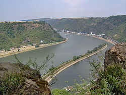
The name comes from the old German words lureln, Rhine dialect for "murmuring", and the Celtic term ley "rock". The translation of the name would therefore be: "murmur rock" or "murmuring rock". The heavy currents, and a small waterfall
in the area (still visible in the early 19th century) created a
murmuring sound, and this combined with the special echo the rock
produces to act as a sort of amplifier, giving the rock its name.[1]
The murmuring is hard to hear today owing to the urbanization of the
area. Other theories attribute the name to the many accidents, by
combining the German verb "lauern" (to lurk, lie in wait) with the same
"ley" ending, with the translation "lurking rock".
In the German language orthographic reform of 1903, in almost all German terms the letter "y" was changed to the letter "i", but in some German names the letter "y" was kept, such as Bayern, Speyer, Spay, (Rheinberg-)Orsoy, and including Loreley, which is thus the correct spelling in German.
The rock and the murmur it creates have inspired various tales. An old legend envisioned dwarfs living in caves in the rock.
In 1801, German author Clemens Brentano composed his ballad Zu Bacharach am Rheine as part of a fragmentary continuation of his novel Godwi oder Das steinerne Bild der Mutter. It first told the story of an enchanting female associated with the rock. In the poem, the beautiful Lore Lay, betrayed by her sweetheart, is accused of bewitching men and causing their death. Rather than sentence her to death, the bishop consigns her to a nunnery. On the way thereto, accompanied by three knights, she comes to the Lorelei rock. She asks permission to climb it and view the Rhine once again. She does so and thinking that she sees her love in the Rhine, falls to her death; the rock still retained an echo of her name afterwards. Brentano had taken inspiration from Ovid and the Echo myth.
In 1824, Heinrich Heine seized on and adapted Brentano's theme in one of his most famous poems, "Die Lorelei". It describes the eponymous female as a sort of siren who, sitting on the cliff above the Rhine and combing her golden hair, unwittingly distracted shipmen with her beauty and song, causing them to crash on the rocks. In 1837 Heine's lyrics were set to music by Friedrich Silcher in the art song "Lorelei"[2] that became well known in German-speaking lands. A setting by Franz Liszt was also favored and dozens of other musicians have set the poem to music.[3]
The Lorelei character, although originally imagined by Brentano, passed into German popular culture in the form described in the Heine–Silcher song and is commonly but mistakenly believed to have originated in an old folk tale. The French writer Guillaume Apollinaire took up the theme again in his poem "La Loreley", from the collection Alcools which is later cited in Symphony No. 14 (3rd movement) of Dmitri Shostakovich.
The Lorelei (German: Loreley) is a 132 m (433 ft) high, steep slate rock on the right bank of the river Rhine in the Rhine Gorge (or Middle Rhine) at Sankt Goarshausen in Germany.

The Lorelei in 1900

Heine + Turner

View of the Rhine as seen from the Lorelei
In the German language orthographic reform of 1903, in almost all German terms the letter "y" was changed to the letter "i", but in some German names the letter "y" was kept, such as Bayern, Speyer, Spay, (Rheinberg-)Orsoy, and including Loreley, which is thus the correct spelling in German.

In 1801, German author Clemens Brentano composed his ballad Zu Bacharach am Rheine as part of a fragmentary continuation of his novel Godwi oder Das steinerne Bild der Mutter. It first told the story of an enchanting female associated with the rock. In the poem, the beautiful Lore Lay, betrayed by her sweetheart, is accused of bewitching men and causing their death. Rather than sentence her to death, the bishop consigns her to a nunnery. On the way thereto, accompanied by three knights, she comes to the Lorelei rock. She asks permission to climb it and view the Rhine once again. She does so and thinking that she sees her love in the Rhine, falls to her death; the rock still retained an echo of her name afterwards. Brentano had taken inspiration from Ovid and the Echo myth.
In 1824, Heinrich Heine seized on and adapted Brentano's theme in one of his most famous poems, "Die Lorelei". It describes the eponymous female as a sort of siren who, sitting on the cliff above the Rhine and combing her golden hair, unwittingly distracted shipmen with her beauty and song, causing them to crash on the rocks. In 1837 Heine's lyrics were set to music by Friedrich Silcher in the art song "Lorelei"[2] that became well known in German-speaking lands. A setting by Franz Liszt was also favored and dozens of other musicians have set the poem to music.[3]
The Lorelei character, although originally imagined by Brentano, passed into German popular culture in the form described in the Heine–Silcher song and is commonly but mistakenly believed to have originated in an old folk tale. The French writer Guillaume Apollinaire took up the theme again in his poem "La Loreley", from the collection Alcools which is later cited in Symphony No. 14 (3rd movement) of Dmitri Shostakovich.
********************

German, Wurtzburg

Germany, Wurtzburg (back of card)
Würzburg (/ˈvɜːrtsbɜːrɡ, ˈwɜːrtsbɜːrɡ/;[2] German pronunciation: [ˈvʏɐ̯tsbʊɐ̯k] ( listen); Main-Franconian: Wörtzburch) is a city in the region of Franconia, northern Bavaria, Germany. Located on the Main River, it is the capital of the Regierungsbezirk of Lower Franconia. The regional dialect is East Franconian.
Würzburg lies about equidistant from Frankfurt am Main and from Nuremberg (each about 120 kilometers or 75 miles away). Although the city of Würzburg is not part of the Landkreis Würzburg, (i.e., district of Würzburg), it is the seat of the district's administration. The city has a population of around 124,000 people.


On the eve of the Nazis' rise to power, 2,000 Jews lived in Würzburg; it was a community of tradesmen and professionals. Würzburg was a rabbinic center and home to many Jewish communal organisations and the Jewish Teachers Seminary. In November 1941, the first Jews from Würzburg were sent to the Nazi concentration camps in Eastern Europe. The final transport departed in June 1943. Few[weasel words] survived.[8]
On 16 March 1945, about 90% of the city was destroyed in 17 minutes by fire bombing from 225 British Lancaster bombers during a World War II air raid, despite the presence of 40 hospitals and the absence of any major armament producer. Wüzburg became a target for its role as a traffic hub and to break the spirit of the population.[6]:19
All of the city's churches, cathedrals, and other monuments were heavily damaged or destroyed. The city center, which mostly dated from medieval times, was totally destroyed in a firestorm in which 5,000 people perished.
Over the next 20 years, the buildings of historical importance were painstakingly and accurately reconstructed. The citizens who rebuilt the city immediately after the end of the war were mostly women – Trümmerfrauen ("rubble women") – because the men were either dead or still prisoners of war. On a relative scale, Würzburg was destroyed to a larger extent than was Dresden in a firebombing the previous month.
On 3 April 1945, Würzburg was occupied by the U.S. 12th Armored Division and U.S. 42nd Infantry Division in a series of frontal assaults masked by smokescreens. The battle continued until the final Wehrmacht resistance was defeated on 5 April 1945.[9][10]
The 2016 Würzburg train attack took place at the Würzburg-Heidingsfeld railway station on 18 July.
Würzburg (/ˈvɜːrtsbɜːrɡ, ˈwɜːrtsbɜːrɡ/;[2] German pronunciation: [ˈvʏɐ̯tsbʊɐ̯k] (
Würzburg lies about equidistant from Frankfurt am Main and from Nuremberg (each about 120 kilometers or 75 miles away). Although the city of Würzburg is not part of the Landkreis Würzburg, (i.e., district of Würzburg), it is the seat of the district's administration. The city has a population of around 124,000 people.
Impression of the city seal of 1319

Woodcut depicting Würzburg from the Nuremberg Chronicle (1493)
Panorama of Würzburg with castle Marienberg. Matthäus Merian in Cornelis Danckerts, "Historis", 1642.
On the eve of the Nazis' rise to power, 2,000 Jews lived in Würzburg; it was a community of tradesmen and professionals. Würzburg was a rabbinic center and home to many Jewish communal organisations and the Jewish Teachers Seminary. In November 1941, the first Jews from Würzburg were sent to the Nazi concentration camps in Eastern Europe. The final transport departed in June 1943. Few[weasel words] survived.[8]
On 16 March 1945, about 90% of the city was destroyed in 17 minutes by fire bombing from 225 British Lancaster bombers during a World War II air raid, despite the presence of 40 hospitals and the absence of any major armament producer. Wüzburg became a target for its role as a traffic hub and to break the spirit of the population.[6]:19
All of the city's churches, cathedrals, and other monuments were heavily damaged or destroyed. The city center, which mostly dated from medieval times, was totally destroyed in a firestorm in which 5,000 people perished.
Over the next 20 years, the buildings of historical importance were painstakingly and accurately reconstructed. The citizens who rebuilt the city immediately after the end of the war were mostly women – Trümmerfrauen ("rubble women") – because the men were either dead or still prisoners of war. On a relative scale, Würzburg was destroyed to a larger extent than was Dresden in a firebombing the previous month.
On 3 April 1945, Würzburg was occupied by the U.S. 12th Armored Division and U.S. 42nd Infantry Division in a series of frontal assaults masked by smokescreens. The battle continued until the final Wehrmacht resistance was defeated on 5 April 1945.[9][10]
The 2016 Würzburg train attack took place at the Würzburg-Heidingsfeld railway station on 18 July.
********************
ITALY
Italy, Merano

Italy, Merano (back of card)
Merano (Italian pronunciation: [meˈraːno] listen (help·info)) or Meran (German pronunciation: [merˈaˑn]) is a town and comune in South Tyrol, northern Italy. Generally best known for its spa resorts, it is located within a basin, surrounded by mountains standing up to 3,335 metres (10,942 feet) above sea level, at the entrance to the Passeier Valley and the Vinschgau.
In the past, the town has been a popular place of residence for several scientists, literary people, and artists, including Franz Kafka, Ezra Pound, Paul Lazarsfeld, and also Empress Elisabeth of Austria, who appreciated its mild climate.
Meran is the German name for the town; Merano is the Italian name. Both are used in English. The Ladin form of the name is Maran. The official name of the municipality (comune) is Stadtgemeinde Meran in German and Comune di Merano in Italian (both are in official use).
In 17th-century Latin, the town was called Meranum.[1] Other archaic names are Mairania (from 857 AD) and an der Meran (from the 15th century).[2]


The area has been inhabited since the 3rd millennium BC, as shown by the presence of menhirs and other findings. The story of the city proper began in 15 BC when the Romans occupied the Adige valley founding a road station, Statio Maiensis.
The settlement was first mentioned in an 857 deed as Mairania. The Counts at Castle Tyrol elevated Meran to the status of a city during the 13th century and made it the capital of their County of Tyrol. After the county had been handed over to the Habsburg dynasty in 1363 upon the abdication of Margaret, Countess of Tyrol, in 1420, Duke Friedrich IV of Austria moved the Tyrolean court to Innsbruck. Though Meran remained the official capital until 1848, it subsequently lost its predominant position and almost all its importance as an economic hub across the roads connecting Italy and Germany. The important mint was also moved to Hall in 1477.
The Tyrolean Rebellion of 1809 against the French occupation drew attention again to Meran. In that year, on the Küchelberg above the city, a peasants' army eked out a victory against the united French and Bavarian forces, before their revolt was finally crushed. After World War I, under the Treaty of Saint-Germain-en-Laye Meran became part of the Kingdom of Italy with the rest of the southern part of the former Cisleithanian crown land of Tyrol.
On 12 April 2010, a train bound for Merano was hit by a mudslide 30 kilometres (19 miles) from the city between the villages of Latsch and Kastelbell. The resulting train derailment killed 9 people and injured 28; 7 of those seriously.[3][4][5]

Among the town's landmarks are the medieval city gates such as the Vinschgauer Tor, Passeirer Tor, and the Bozener Tor. Also belonging to the fortifications is the medieval Ortenstein tower, popularly called Pulverturm (lit. "powder tower").
The main churches are the Gothic St. Nicholas' Church and the St. Barbara's Chapel, both dating to the 15th century. Also dating to this period is the Princely Castle (Landesfürstliche Burg), which was a residence of Archduke Sigismund of Austria.
The Steinerner Steg stone bridge crosses the Passer river and dates to the 17th century.
The town saw further development as it became increasingly popular as a spa resort, especially after Empress Elisabeth of Austria started visiting. Dating from the 19th century are civic theatre, the Kurhaus and the Empress Elisabeth Park. Also famous are the arched Wandelhalle promenades along the river.
After the annexation of the town to Italy in 1919, the Fascist authorities constructed the new town hall in the 1920s.
Outside the town is Trauttmansdorff Castle and its gardens. Also located there is the Museum of Tourism, which was opened in the spring of 2003 and shows the historical development of tourism in the province. Tirol Castle is also close-by.
In the past, the town has been a popular place of residence for several scientists, literary people, and artists, including Franz Kafka, Ezra Pound, Paul Lazarsfeld, and also Empress Elisabeth of Austria, who appreciated its mild climate.
Meran is the German name for the town; Merano is the Italian name. Both are used in English. The Ladin form of the name is Maran. The official name of the municipality (comune) is Stadtgemeinde Meran in German and Comune di Merano in Italian (both are in official use).
In 17th-century Latin, the town was called Meranum.[1] Other archaic names are Mairania (from 857 AD) and an der Meran (from the 15th century).[2]
Origin

Historical map of Meran and surrounding area (1888).

The town's coat of arms on the Postbrücke.
The settlement was first mentioned in an 857 deed as Mairania. The Counts at Castle Tyrol elevated Meran to the status of a city during the 13th century and made it the capital of their County of Tyrol. After the county had been handed over to the Habsburg dynasty in 1363 upon the abdication of Margaret, Countess of Tyrol, in 1420, Duke Friedrich IV of Austria moved the Tyrolean court to Innsbruck. Though Meran remained the official capital until 1848, it subsequently lost its predominant position and almost all its importance as an economic hub across the roads connecting Italy and Germany. The important mint was also moved to Hall in 1477.
The Tyrolean Rebellion of 1809 against the French occupation drew attention again to Meran. In that year, on the Küchelberg above the city, a peasants' army eked out a victory against the united French and Bavarian forces, before their revolt was finally crushed. After World War I, under the Treaty of Saint-Germain-en-Laye Meran became part of the Kingdom of Italy with the rest of the southern part of the former Cisleithanian crown land of Tyrol.
On 12 April 2010, a train bound for Merano was hit by a mudslide 30 kilometres (19 miles) from the city between the villages of Latsch and Kastelbell. The resulting train derailment killed 9 people and injured 28; 7 of those seriously.[3][4][5]

St. Nicholas' Church
The main churches are the Gothic St. Nicholas' Church and the St. Barbara's Chapel, both dating to the 15th century. Also dating to this period is the Princely Castle (Landesfürstliche Burg), which was a residence of Archduke Sigismund of Austria.
The Steinerner Steg stone bridge crosses the Passer river and dates to the 17th century.
The town saw further development as it became increasingly popular as a spa resort, especially after Empress Elisabeth of Austria started visiting. Dating from the 19th century are civic theatre, the Kurhaus and the Empress Elisabeth Park. Also famous are the arched Wandelhalle promenades along the river.
After the annexation of the town to Italy in 1919, the Fascist authorities constructed the new town hall in the 1920s.
Outside the town is Trauttmansdorff Castle and its gardens. Also located there is the Museum of Tourism, which was opened in the spring of 2003 and shows the historical development of tourism in the province. Tirol Castle is also close-by.
********************
SWITZERLAND

Switzerland, Belizona
Bellinzona (Italian pronunciation: [bellinˈtsoːna];[4] French: Bellinzone [bɛlɛ̃zon], German: Bellenz [ˈbɛlɛnts], Romansh: Blizuna [bliˈtsuːnə] ( listen)) is the capital of the canton Ticino in Switzerland. The city is famous for its three castles (Castelgrande, Montebello, Sasso Corbaro) that have been UNESCO World Heritage Sites since 2000.
The town lies east of the Ticino river, at the foot of the Alps. It stretches along the river valley, surrounded by the southern ranges of the Lepontine Alps to the east and west, and by the Lugano Prealps to the south.
The town lies east of the Ticino river, at the foot of the Alps. It stretches along the river valley, surrounded by the southern ranges of the Lepontine Alps to the east and west, and by the Lugano Prealps to the south.

View of Bellinzona from Castello Montebello

Piazza del Sole, Post Office and Station
********************

Switzerland, Jungfrau Mountain, Swiss Alps, Eiger Mounter near Wengen
The Jungfrau ("maiden, virgin"[note 3][1][2]) at 4,158 metres (13,642 ft) is one of the main summits of the Bernese Alps, located between the northern canton of Bern and the southern canton of Valais, halfway between Interlaken and Fiesch. Together with the Eiger and Mönch, the Jungfrau forms a massive wall overlooking the Bernese Oberland and the Swiss Plateau, one of the most distinctive sights of the Swiss Alps.
The summit was first reached on August 3, 1811 by the Meyer brothers of Aarau and two chamois hunters from Valais. The ascent followed a long expedition over the glaciers and high passes of the Bernese Alps. It was not until 1865 that a more direct route on the northern side was opened.
The construction of the Jungfrau railway in the early 20th century, which connects Kleine Scheidegg to the Jungfraujoch, the saddle between the Mönch and the Jungfrau, made the area one of the most-visited places in the Alps. Along with the Aletsch Glacier to the south, the Jungfrau is part of the Jungfrau-Aletsch area, which was declared a World Heritage Site in 2001.

The Jungfrau is the westernmost and highest point of a gigantic 10 km wall dominating the valleys of Lauterbrunnen and Grindelwald. The wall is formed by the alignment of some of the biggest north faces in the Alps, with the Mönch (4,107 m) and Eiger
(3,967 m) to the east of the Jungfrau, and overlooks the valleys to its
north by a height of up to 3 km. The Jungfrau is approximately 6 km
from the Eiger; with the summit of the Mönch between the two mountains,
3.5 km from the Jungfrau. The wall is extended to the east by the Fiescherwand and to the west by the Lauterbrunnen Wall.
The difference of altitude between the deep valley of Lauterbrunnen (800 m) and the summit is particularly visible from the area of Mürren. From the valley floor, west of the massif, the altitude gain is more than 3 km for a horizontal distance of 4 km.
The landscapes around the Jungfrau are extremely contrasted. Instead of the vertiginous precipices of the north-west, the south-east side emerges from the upper snows of the Aletsch Glacier at around 3,500 metres. The 20 km long valley of Aletsch on the south-east is completely uninhabited and also surrounded by other similar glacier valleys. The whole area constitutes the largest glaciated area in the Alps as well as in Europe.[4]


The summit was first reached on August 3, 1811 by the Meyer brothers of Aarau and two chamois hunters from Valais. The ascent followed a long expedition over the glaciers and high passes of the Bernese Alps. It was not until 1865 that a more direct route on the northern side was opened.
The construction of the Jungfrau railway in the early 20th century, which connects Kleine Scheidegg to the Jungfraujoch, the saddle between the Mönch and the Jungfrau, made the area one of the most-visited places in the Alps. Along with the Aletsch Glacier to the south, the Jungfrau is part of the Jungfrau-Aletsch area, which was declared a World Heritage Site in 2001.
Politically, the Jungfrau is split between the municipalities of Lauterbrunnen (Bern) and Fieschertal (Valais). It is the third-highest mountain of the Bernese Alps after the nearby Finsteraarhorn and Aletschhorn, respectively 12 and 8 km away.[3] But from Lake Thun, and the greater part of the canton of Bern, it is the most conspicuous and the nearest of the Bernese Oberland peaks; with a height difference of 3,600 m between the summit and the town of Interlaken. This, and the extreme steepness of the north face, secured for it an early reputation for inaccessibility.

The Jungfrau and the valley of Lauterbrunnen from Interlaken
The difference of altitude between the deep valley of Lauterbrunnen (800 m) and the summit is particularly visible from the area of Mürren. From the valley floor, west of the massif, the altitude gain is more than 3 km for a horizontal distance of 4 km.
The landscapes around the Jungfrau are extremely contrasted. Instead of the vertiginous precipices of the north-west, the south-east side emerges from the upper snows of the Aletsch Glacier at around 3,500 metres. The 20 km long valley of Aletsch on the south-east is completely uninhabited and also surrounded by other similar glacier valleys. The whole area constitutes the largest glaciated area in the Alps as well as in Europe.[4]

View over of the Aletsch Glacier and Concordia from the summit of the Jungfrau

The summit from near the Rottalsattel

Eiger, Mönch and Jungfrau
********************

Switzerland, Locarno Madonna Del Sasso
The Madonna del Sasso is a sanctuary and pilgrimage church in Orselina, above the city of Locarno in Switzerland. It is the principal sight and goal of pilgrimage in the city.
The founding of the sanctuary goes back to a vision of the Virgin Mary that the Franciscan brother Bartolomeo d'Ivrea experienced in the night of 14/15 August 1480. The interior is highly decorated, and a platform gives a magnificent view of the city.
The sanctuary is linked to Locarno city centre by the Locarno–Madonna del Sasso funicular.
********************
(Post Card and pamphlet)

Switzerland, Lotos - Locarno


Switzerland Locarno pension

Switzerland Locarno Pension Lotos

Switzerland, Lorcano pension Lotos

Switzerland, Locarno Restaurant
Locarno (Italian: [loˈkarno], German: [loˈkarno]; Ticinese: Locarn [loˈkɑːrn]; formerly in German: Luggárus [luˈɡaːrʊs]) is a southern Swiss town and municipality in the district Locarno (and its capital), located on the northern shore of Lake Maggiore at its northeastern tip in the canton of Ticino at the southern foot of the Swiss Alps. It has a population of about 16,000 (proper), and about 56,000 for the agglomeration of the same name including Ascona besides other municipalities.[3]
The town of Locarno is located on the northeastern part of Maggia's delta; across the river lies the town Ascona on the southwestern part of the delta.
It is the 74th largest city in Switzerland by population[citation needed] and the third largest in the Ticino canton, after Lugano and Bellinzona.
The official language of Locarno is Italian.
The town is known for hosting the Locarno International Film Festival which takes place every year in August and involves open-air screenings at the main square, the Piazza Grande. It is also known for the Locarno Treaties, a series of European territorial agreements negotiated here in October 1925.
In January 2004, the Italian historian Marino Vigano speculated that Locarno's castle may have been designed by Leonardo da Vinci.[4]
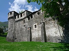
There were several castles from the Early Middle Ages
in Locarno. One was destroyed by the Milanese in 1156. Another, first
mentioned in 1210 as Orelli castle, was occupied in 1342 occupied by the
Visconti and enlarged. This castle came to be known as Visconti Castle.
In 1531, the Confederates demolished much of the castle, leaving only
the central core. The castle was used as the residence of the governor,
but in the following centuries, it began to fall apart. From 1804 to
1909, the castle was the seat of the administrative governor and the
District Court. After 1909, it came into the possession of the city and
was renovated in 1921-28. Since 1920, it houses the city and
Archaeological Museum. In 1507, a defensive bastion or Ravelin was added to protect the castle entrance. It is likely that Leonardo da Vinci designed this structure.[4][6] North-east of the castle is Palazzo Casorella (Casa degli Orelli) from the 16th century.
The town of Locarno is located on the northeastern part of Maggia's delta; across the river lies the town Ascona on the southwestern part of the delta.
It is the 74th largest city in Switzerland by population[citation needed] and the third largest in the Ticino canton, after Lugano and Bellinzona.
The official language of Locarno is Italian.
The town is known for hosting the Locarno International Film Festival which takes place every year in August and involves open-air screenings at the main square, the Piazza Grande. It is also known for the Locarno Treaties, a series of European territorial agreements negotiated here in October 1925.
In January 2004, the Italian historian Marino Vigano speculated that Locarno's castle may have been designed by Leonardo da Vinci.[4]

Castello Visconteo
********************

Switzerland, Lucerne near Mount Rigi
Lucerne (/ˌluːˈsɜːrn/; German: Luzern [luˈtsɛrn] ( listen); French: Lucerne [lysɛʁn]; Italian: Lucerna [luˈtʃɛrna]; Romansh: Lucerna; Lucerne Swiss-German: Lozärn) is a city in central Switzerland, in the German-speaking portion of the country. Lucerne is the capital of the canton of Lucerne and part of the district of the same name. With a population of about 81,057 people (as of 2013),[3] Lucerne is the most populous town in Central Switzerland, and a nexus of economics, transportation, culture, and media of this region. The city's urban area consists of 17 municipalities and towns located in three different cantons with an overall population of about 250,000 people (as of 2007).[4]
Owing to its location on the shores of Lake Lucerne (German: Vierwaldstättersee) and its outflow, the river Reuss, within sight of the mounts Pilatus and Rigi in the Swiss Alps, Lucerne has long been a destination for tourists. One of the city's famous landmarks is the Chapel Bridge (German: Kapellbrücke), a wooden bridge first erected in the 14th century.
The official language of Lucerne is (the Swiss variety of Standard) German, but the main spoken language is the local variant of the Alemannic Swiss German dialect.
Lucerne (/ˌluːˈsɜːrn/; German: Luzern [luˈtsɛrn] (
Owing to its location on the shores of Lake Lucerne (German: Vierwaldstättersee) and its outflow, the river Reuss, within sight of the mounts Pilatus and Rigi in the Swiss Alps, Lucerne has long been a destination for tourists. One of the city's famous landmarks is the Chapel Bridge (German: Kapellbrücke), a wooden bridge first erected in the 14th century.
The official language of Lucerne is (the Swiss variety of Standard) German, but the main spoken language is the local variant of the Alemannic Swiss German dialect.
The Rigi (or Mount Rigi; also known as Queen of the Mountains) is a mountain massif of the Alps, located in Central Switzerland. The whole massif is almost entirely surrounded by the water of three different water bodies: Lake Lucerne, Lake Zug and Lake Lauerz. The range is in the Schwyzer Alps, and is split between the cantons of Schwyz and Lucerne, although the main summit, named Rigi Kulm, at 1,798 meters above sea level, lies within the canton of Schwyz.
The Rigi Kulm and other areas, such as the resort of Rigi Kaltbad, are served by Europe's oldest mountain railways, the Rigi Railways. The whole area offers many activities such as skiing or sledging in the winter, and hiking in the summer.
The name Rigi is from Swiss Old High German *rigî "horizontal stratification, strip, band", from OHG rîhan "gird; pleat, string", cf. OHG rîga "row, stripe, furrow", after the horizontal rock ledges and grass strips surrounding the mountain from west to east.[3][4] The name is first recorded in 1350 as Riginun.
The name was interpreted as Regina montium "queen of mountains" by Albrecht von Bonstetten (1479), who however gives Rigena as alternative form.[5]
Bonstetten's interpretation as Regina was influential in the 17th century, and was still repeated in 18th-century travelogues. Karl Zay (Goldau und seine Gegend, 1807) criticized this latinization, arguing for mons rigidus instead. Later in the 19th century, many authors repeated either rigidus or regina as the name's supposed origin. The two possibilities were also adduced as explanation the name's grammatical gender alternating between masculine and feminine.[6] Brandstetter (Die Rigi, 1914) finally discredited these interpretations and established the origin in Old High German rîga (whence modern German Reihe, Reigen; cognate with English row).

There are multiple public transport options available to ascend Mt. Rigi:
Rigi is also a perfect destination for people practising winter sports and other winter recreation activities.
The Rigi Kulm and other areas, such as the resort of Rigi Kaltbad, are served by Europe's oldest mountain railways, the Rigi Railways. The whole area offers many activities such as skiing or sledging in the winter, and hiking in the summer.
Peaks
| Name of peak | Height above sea (in meter) | Canton |
|---|---|---|
| Rigi Kulm | 1,797.5 m (5,897 ft) | SZ |
| Rotstock | 1,658 m (5,440 ft) | LU/SZ border |
| Dosse | 1,684 m (5,525 ft) | LU/SZ border |
| Scheidegg | 1,658 m (5,440 ft) | SZ |
| Vitznauerstock (LU)/Gersauerstock (SZ) | 1,452 m (4,764 ft) | LU/SZ border |
| Rigi Hochflue (Urmiberg) | 1,698 m (5,571 ft) | SZ |
Etymology

Depiction of Rigi as the center of the Swiss Confederacy (Albrecht von Bonstetten, 1479)
The name was interpreted as Regina montium "queen of mountains" by Albrecht von Bonstetten (1479), who however gives Rigena as alternative form.[5]
Bonstetten's interpretation as Regina was influential in the 17th century, and was still repeated in 18th-century travelogues. Karl Zay (Goldau und seine Gegend, 1807) criticized this latinization, arguing for mons rigidus instead. Later in the 19th century, many authors repeated either rigidus or regina as the name's supposed origin. The two possibilities were also adduced as explanation the name's grammatical gender alternating between masculine and feminine.[6] Brandstetter (Die Rigi, 1914) finally discredited these interpretations and established the origin in Old High German rîga (whence modern German Reihe, Reigen; cognate with English row).

Postcard from Rigi (1906).
- By rack railway from Arth-Goldau and Vitznau, operated by the Rigi Bahnen. The Vitznau-Rigi-Bahn started operation on May 21, 1871 and was the first mountain railway in Europe. On June 4, 1875 the Arth-Rigi-Bahn was finished, allowing access from the other side of the mountain. They were electrified in 1937 and 1907 respectively, with the Arth-Rigi-Bahn becoming the first electrified standard gauge rack-railway in the world. Both lines go all the way to the summit, Rigi Kulm.
- By gondola lift from Weggis to Rigi-Kaltbad.
- By cable-car from the Kräbel station on the Arth-Rigi-Bahn line to Rigi-Scheidegg.
Mt. Rigi offers an area for recreation and sports measuring approximately 90 square kilometres (35 sq mi) offering a variety of well-maintained walking trails or mountain hikes where visitors can have a panoramic view of 150 km (93 mi) from various marked points. There are also numerous public grilling stations located near the hiking trails.
Rigi is also a perfect destination for people practising winter sports and other winter recreation activities.
********************

Switzerland, Montreaux
Montreux (French pronunciation: [mɔ̃tʁø]) is a municipality in the district of Riviera-Pays-d'Enhaut in the canton of Vaud in Switzerland.
It is located on Lake Geneva shoreline at the foot of the Alps and has a population, as of December 2016, of 26,629[2] and nearly 90,000 in the agglomeration.[3]
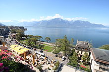
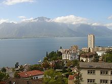
It is located on Lake Geneva shoreline at the foot of the Alps and has a population, as of December 2016, of 26,629[2] and nearly 90,000 in the agglomeration.[3]

Lake Geneva from Montreux

Montreux and Lake Geneva
********************

Switzerland, Oberer Reichenbachfall
The Reichenbach Falls (German: Reichenbachfälle) are a waterfall cascade of seven steps on the creek called Rychenbach in the Bernese Oberland region of Switzerland.[1] They drop over a total change of altitude of about 250 metres (820 ft).[citation needed] At 110 metres (360 ft), of which the Grand Reichenbach Fall (German: Grosser Reichenbachfall), the upper one, is by far the largest one and one of the higher waterfalls in the Alps and among the forty highest in Switzerland.[2] The Rychenbach loses 290 metres (950 ft) of height from the top of the falls to the valley floor of the Haslital.[1] Today, a hydro-electric power company harnesses the flow of the Reichenbach Falls during certain times of year, reducing its flow.[3][4]
********************

Switzerland, Rhine Falls
The Rhine Falls (German: Rheinfall, singular) is the largest waterfall in Switzerland, Europe.[1][2]
The falls are located on the High Rhine on the border between the cantons of Schaffhausen (SH) and Zürich (ZH), between the municipalities of Neuhausen am Rheinfall (SH) and Laufen-Uhwiesen/Dachsen (ZH), next to the town of Schaffhausen in northern Switzerland.
They are 150 metres (490 ft) wide and 23 metres (75 ft) high. In the winter months, the average water flow is 250 m3/s (8,800 cu ft/s), while in the summer, the average water flow is 600 m3/s (21,000 cu ft/s). The highest flow ever measured was 1,250 cubic metres per second (44,000 cu ft/s) in 1965; and the lowest, 95 cubic metres per second (3,400 cu ft/s) in 1921.[3]
The falls can not be climbed by fish, except by eels that are able to worm their way up over the rocks.

The Rhine Falls were formed in the last ice age, approximately 14,000 to 17,000 years ago, by erosion-resistant rocks narrowing the riverbed. The first glacial advances created today's landforms approximately 500,000 years ago. Up to the end of the Wolstonian Stage approximately 132,000 years ago, the Rhine flowed westwards from Schaffhausen past Klettgau. This earlier riverbed later filled up with gravel.
About 132,000 years ago the course of the river changed southwards at Schaffhausen and formed a new channel, which also filled up with gravel. Part of the Rhine today includes this ancient riverbed.
During the Würm glaciation, the Rhine was pushed far to the south to its present course, over a hard Late Jurassic limestone bed. As the river flowed over both the hard limestone and the easily eroded gravel from previous glaciations, the current waterfall formed about 14,000 to 17,000 years ago. The Rheinfallfelsen, a large rock, is the remnant of the original limestone cliff flanking the former channel. The rock has eroded very little over the years because relatively little sediment comes down the Rhine from Lake Constance.
The falls are located on the High Rhine on the border between the cantons of Schaffhausen (SH) and Zürich (ZH), between the municipalities of Neuhausen am Rheinfall (SH) and Laufen-Uhwiesen/Dachsen (ZH), next to the town of Schaffhausen in northern Switzerland.
They are 150 metres (490 ft) wide and 23 metres (75 ft) high. In the winter months, the average water flow is 250 m3/s (8,800 cu ft/s), while in the summer, the average water flow is 600 m3/s (21,000 cu ft/s). The highest flow ever measured was 1,250 cubic metres per second (44,000 cu ft/s) in 1965; and the lowest, 95 cubic metres per second (3,400 cu ft/s) in 1921.[3]
The falls can not be climbed by fish, except by eels that are able to worm their way up over the rocks.

The Rhine Falls seen from the Rhine
About 132,000 years ago the course of the river changed southwards at Schaffhausen and formed a new channel, which also filled up with gravel. Part of the Rhine today includes this ancient riverbed.
During the Würm glaciation, the Rhine was pushed far to the south to its present course, over a hard Late Jurassic limestone bed. As the river flowed over both the hard limestone and the easily eroded gravel from previous glaciations, the current waterfall formed about 14,000 to 17,000 years ago. The Rheinfallfelsen, a large rock, is the remnant of the original limestone cliff flanking the former channel. The rock has eroded very little over the years because relatively little sediment comes down the Rhine from Lake Constance.
********************

Samedan (
Samedan is first mentioned in 1139 as Samaden. In 1334 it was mentioned as Semeden, in 1367 as Semaden, in 1498 as Sumada and in 1527 as Sameden.[3] Samedan is the location of The Smallest Whiskey Bar on Earth, the establishment holding the Guinness World Records distinction of "Smallest Permanently Licensed Bar in the World."
********************
No comments:
Post a Comment